
 San Pedro
Retamar
Noblejas
La Selva
Igollo
Cintruénigo
Benejúzar
Balboa
Cala
Sant Andreu
Premià de Dalt
Santa Coloma de Gramenet
Arroyo de San Serván
Morata de Jalón
Sant Julià de Ramis
Maià de Montcal
Bera
Calella
Écija
San Pedro
Retamar
Noblejas
La Selva
Igollo
Cintruénigo
Benejúzar
Balboa
Cala
Sant Andreu
Premià de Dalt
Santa Coloma de Gramenet
Arroyo de San Serván
Morata de Jalón
Sant Julià de Ramis
Maià de Montcal
Bera
Calella
Écija
Almansa on the map, Spain
Where is located Almansa
Exact location — Almansa, Albacete, Castilla-La Mancha, Spain, marked on the map with a red marker.
Coordinates
Almansa, Spain coordinates in decimal format: latitude — 38.8702789, longitude — -1.0993366. When converted to degrees, minutes, seconds Almansa has the following coordinates: 38°52′13 north latitude and -1°5′57.61 east longitude.
Population
Almansa, Albacete, Castilla-La Mancha, Spain, according to our data the population is — 24,502 residents, which is about 0.1% of the total population of the country (Spain).
Comparison of the population on the graph:
Exact time
Time zone for this location Almansa — UTC +2 Europe/Madrid. Exact time — sunday, 6 june 2024 year, 16 h. 08 minutes.
Sunrise and sunset
Almansa, sunrise and sunset data for a date — sunday 16.06.2024.
| Sunrise | Sunset | Day (duration) |
|---|---|---|
| 06:42 -0 minutes | 21:28 +1 minute | 14 h. 48 minutes. +1 minute |
You can control the scale of the map using the auxiliary tools to find out exactly where it is located Almansa. When you change the scale of the map, the width of the ruler also changes (in kilometers and miles).
Nearby cities
The largest cities that are located nearby:
- Albacete — 67 km
- Valencia — 91 km
- Murcia — 97 km
- Cartagena — 138 km
- Almería — 255 km
- Alcala de Henares — 261 km
- Jaén — 264 km
- Torrejón de Ardoz — 266 km
- Getafe — 273 km
- Fuenlabrada — 277 km
- Leganés — 277 km
- Alcobendas — 282 km
- Alcorcón — 282 km
- Móstoles — 283 km
- Granada — 289 km
- Zaragoza — 308 km
- Tarragona — 316 km
- Palma — 329 km
- Lleida — 335 km
Distance to neighboring capitals:
- Andorra la Vella
 (Andorra) — 461 km
 - Lisbon
 (Portugal) — 697 km
 - Rabat
 (Morocco) — 749 km
 - Paris
 (France) — 1144 km
 - Paris (France) — 1144 km
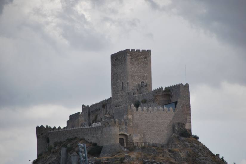
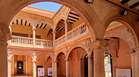
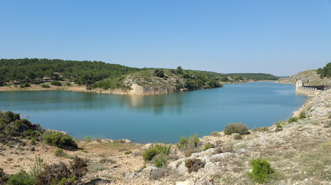
Attractions
Distance to the capital
Distance to the capital (Madrid) is about — 282 km.