ABI Abilene Regional Airport — Kingwood
ABI Abilene Regional Airport — Tucumcari
ABI Abilene Regional Airport — Owenton
ABI Abilene Regional Airport — Sherwood
ABI Abilene Regional Airport — Wilder Landing Strip
ABI Abilene Regional Airport — Pecos
ABI Abilene Regional Airport — Whaleyville
ABI Abilene Regional Airport — Red Rock
ABI Abilene Regional Airport — Rouseville
ABI Abilene Regional Airport — Fairmount City
ABI Abilene Regional Airport — Mayetta
ABI Abilene Regional Airport — New Rochelle
ABI Abilene Regional Airport — Summersville
ABI Abilene Regional Airport — Angora
ABI Abilene Regional Airport — Northport
ABI Abilene Regional Airport — Chestertown
ABI Abilene Regional Airport — Fairdale
ABI Abilene Regional Airport — Wortham
ABI Abilene Regional Airport — Harris County
Trent
Sweetwater
Loraine
Colorado City
Big Spring
Midland
Midland International Air & Space Port
Odessa
Ector County
Penwell
Monahans
Wickett
Pyote
Pecos
Van Horn
Allamoore
Sierra Blanca
Fort Hancock
Fabens
Clint
Zaragoza
ABI Abilene Regional Airport — Kingwood
ABI Abilene Regional Airport — Tucumcari
ABI Abilene Regional Airport — Owenton
ABI Abilene Regional Airport — Sherwood
ABI Abilene Regional Airport — Wilder Landing Strip
ABI Abilene Regional Airport — Pecos
ABI Abilene Regional Airport — Whaleyville
ABI Abilene Regional Airport — Red Rock
ABI Abilene Regional Airport — Rouseville
ABI Abilene Regional Airport — Fairmount City
ABI Abilene Regional Airport — Mayetta
ABI Abilene Regional Airport — New Rochelle
ABI Abilene Regional Airport — Summersville
ABI Abilene Regional Airport — Angora
ABI Abilene Regional Airport — Northport
ABI Abilene Regional Airport — Chestertown
ABI Abilene Regional Airport — Fairdale
ABI Abilene Regional Airport — Wortham
ABI Abilene Regional Airport — Harris County
Trent
Sweetwater
Loraine
Colorado City
Big Spring
Midland
Midland International Air & Space Port
Odessa
Ector County
Penwell
Monahans
Wickett
Pyote
Pecos
Van Horn
Allamoore
Sierra Blanca
Fort Hancock
Fabens
Clint
Zaragoza  El Paso
 International Airport
El Paso
El Paso
El Paso
Santa Teresa
Canutillo
Berino
Vado
Mesilla
Deming
Moon
Lordsburg
Raso
Willcox
Cochise
Dragoon
Benson
Tucson International Airport
Tucson
Marana
Picacho
Eloy
Arizona City
Casa Grande
Sacaton
Casa Blanca
Tempe
Phoenix Sky Harbor International Airport
Phoenix
Phoenix
Tolleson
Avondale
Goodyear
Buckeye
Quartzsite
Ehrenberg
Blythe
Cactus City
Thermal
Indio
Indian Wells
Thousand Palms
El Paso
El Paso International Airport
El Paso
El Paso
El Paso
Santa Teresa
Canutillo
Berino
Vado
Mesilla
Deming
Moon
Lordsburg
Raso
Willcox
Cochise
Dragoon
Benson
Tucson International Airport
Tucson
Marana
Picacho
Eloy
Arizona City
Casa Grande
Sacaton
Casa Blanca
Tempe
Phoenix Sky Harbor International Airport
Phoenix
Phoenix
Tolleson
Avondale
Goodyear
Buckeye
Quartzsite
Ehrenberg
Blythe
Cactus City
Thermal
Indio
Indian Wells
Thousand Palms
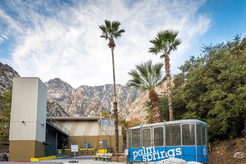
ABI Abilene Regional Airport — Palm Springs distance, route on the map
Distance by car
Distance between ABI Abilene Regional Airport, Texas, United States and Palm Springs, California, United States by car is — km, or miles. To travel this distance by car, you need minute, or h.
Route on the map, driving directions
Car route ABI Abilene Regional Airport — Palm Springs was created automatically. The road on the map is shown as a blue line. By moving the markers, you can create a new route through the points you need.
Passing cities through which the car route passes: Abilene, Trent, Sweetwater, Loraine, Colorado City, Big Spring, Midland, Midland International Air & Space Port, Odessa, Ector County, Penwell, Monahans, Wickett, Pyote, Pecos, Van Horn, Allamoore, Sierra Blanca, Fort Hancock, Fabens, Clint, Zaragoza (mx), El Paso, El Paso International Airport, El Paso, El Paso, El Paso, Santa Teresa, Canutillo, Berino, Vado, Mesilla, Deming, Moon, Lordsburg, Raso, Willcox, Cochise, Dragoon, Benson, Tucson International Airport, Tucson, Marana, Picacho, Eloy, Arizona City, Casa Grande, Sacaton, Casa Blanca, Tempe, Phoenix Sky Harbor International Airport, Phoenix, Phoenix, Tolleson, Avondale, Goodyear, Buckeye, Quartzsite, Ehrenberg, Blythe, Cactus City, Thermal, Indio, Indian Wells, Thousand Palms.
Distance by plane
If you decide to take a trip ABI Abilene Regional Airport Palm Springs by plane, then you have to fly the distance — 1577 km or 978 miles. It is marked on the map with a gray line (between two points in a straight line).
Flight time
Estimated flight time ABI Abilene Regional Airport Palm Springs by plane at cruising speed 750 km / h will be — 2 h. and 6 min.
Direction of movement
United States, ABI Abilene Regional Airport — right-hand traffic. United States, Palm Springs — right-hand traffic.
Difference in time
ABI Abilene Regional Airport and Palm Springs are in different time zones. The time difference is 2 hours (UTC -5 America/Chicago, UTC -7 America/Los_Angeles).
Interesting Facts
Information on alternative ways to get to your destination.
The length of this distance is about 3.9% of the total length of the equator.
The cost of travel
Calculate the cost of the trip yourself using the fuel consumption calculator, changing the data in the table.