
 Mikhaylovka
Dyrestuy
Mikhaylovka
Mayskiy
Novobessergenevka
Tersky District
Lesnoy
Tertezh
Kuz'minskiye Otverzhki
Mikhaylovka
Dyrestuy
Mikhaylovka
Mayskiy
Novobessergenevka
Tersky District
Lesnoy
Tertezh
Kuz'minskiye Otverzhki
Tokhkolodskoye Ozero on the map, Sertolovo, Russian Federation
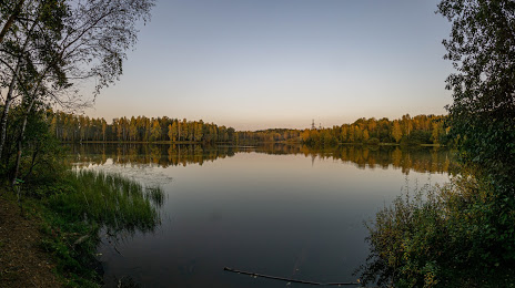
Photo
Where is located Tokhkolodskoye Ozero
Tokhkolodskoye Ozero — local attraction, which is located at no data and belongs to the category — -. Average visitor rating for this place — 4.5 (according to 78 ratings, information from open sources and relevant for 2022).
Exact location — Tokhkolodskoye Ozero, marked on the map with a red marker.
You can get directions to Tokhkolodskoye Ozero on the map from your location.
What else is interesting in Sertolovo? You can see all the sights if you go to the city page.
Coordinates
Tokhkolodskoye Ozero, Russian Federation coordinates in decimal format: latitude — 60.11324491737383, longitude — 30.3010742942644. When converted to degrees, minutes, seconds Tokhkolodskoye Ozero has the following coordinates: 60°6′47.68 north latitude and 30°18′3.87 east longitude.
Nearby cities
The largest cities that are located nearby:
- Saint Petersburg — 25 km
- Kolpino — 51 km
- Pskov — 281 km
- Petrozavodsk — 281 km
- Tartu
 (Estonia) — 282 km
 - Vantaa
 (Finland) — 284 km
 - Helsinki (Finland) — 290 km
- Espoo (Finland) — 306 km
- Tallinn (Estonia) — 317 km
- Tampere (Finland) — 372 km
- Velikiye Luki — 422 km
- Turku (Finland) — 435 km
- Cherepovets — 451 km
- Tver — 501 km
- Rīga
 (Latvia) — 511 km
 - Navapolatsk
 (Belarus) — 523 km
 - Daugavpils (Latvia) — 525 km
- Rybinsk — 555 km
- Vologda — 557 km
Distance to the capital
Distance to the capital (Moscow) is about — 649 km.