
 Mikhaylovka
Dyrestuy
Mikhaylovka
Mayskiy
Novobessergenevka
Tersky District
Lesnoy
Tertezh
Kuz'minskiye Otverzhki
Mikhaylovka
Dyrestuy
Mikhaylovka
Mayskiy
Novobessergenevka
Tersky District
Lesnoy
Tertezh
Kuz'minskiye Otverzhki
1-Ye Zhdanovskoye Ozero on the map, Vsevolozhsk, Russian Federation
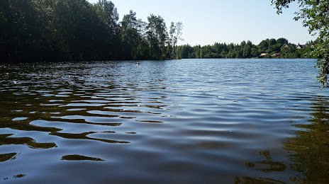
Photo
Where is located 1-Ye Zhdanovskoye Ozero
1-Ye Zhdanovskoye Ozero — local attraction, which is located at 42 m and belongs to the category — -. Average visitor rating for this place — 4.5 (according to 38 ratings, information from open sources and relevant for 2022).
Exact location — 1-Ye Zhdanovskoye Ozero, marked on the map with a red marker.
You can get directions to 1-Ye Zhdanovskoye Ozero on the map from your location.
What else is interesting in Vsevolozhsk? You can see all the sights if you go to the city page.
Coordinates
1-Ye Zhdanovskoye Ozero, Russian Federation coordinates in decimal format: latitude — 59.98994748279708, longitude — 30.679764994561083. When converted to degrees, minutes, seconds 1-Ye Zhdanovskoye Ozero has the following coordinates: 59°59′23.81 north latitude and 30°40′47.15 east longitude.
Nearby cities
The largest cities that are located nearby:
- Saint Petersburg — 21 km
- Kolpino — 33 km
- Petrozavodsk — 272 km
- Pskov — 281 km
- Tartu
 (Estonia) — 293 km
 - Vantaa
 (Finland) — 310 km
 - Helsinki (Finland) — 315 km
- Espoo (Finland) — 331 km
- Tallinn (Estonia) — 339 km
- Tampere (Finland) — 399 km
- Velikiye Luki — 408 km
- Cherepovets — 423 km
- Turku (Finland) — 460 km
- Tver — 473 km
- Navapolatsk
 (Belarus) — 517 km
 - Rīga
 (Latvia) — 522 km
 - Rybinsk — 526 km
- Daugavpils (Latvia) — 526 km
- Vologda — 530 km
Distance to the capital
Distance to the capital (Moscow) is about — 624 km.