
 Pointe-à-la-Croix
Sainte-Irène, Quebec
Marsoui
Hecla
Muskrat Dam
Wunnummin Lake
Sainte-Brigitte-de-Laval
Drayton
Mauricie
Pointe-à-la-Croix
Sainte-Irène, Quebec
Marsoui
Hecla
Muskrat Dam
Wunnummin Lake
Sainte-Brigitte-de-Laval
Drayton
Mauricie
Kitsilano Beach Park on the map, Vancouver, Canada
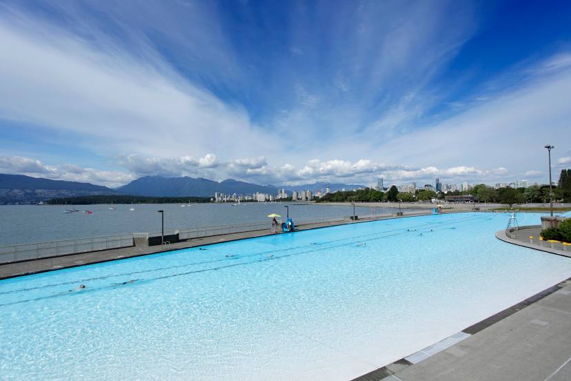
Photo
Where is located Kitsilano Beach Park
Kitsilano Beach Park — local attraction, which is located at 1499 Arbutus St, Vancouver, BC V6J 5N2, Canada and belongs to the category — park. Average visitor rating for this place — 4.6 (according to 6645 ratings, information from open sources and relevant for 2022).
Exact location — Kitsilano Beach Park, marked on the map with a red marker.
You can get directions to Kitsilano Beach Park on the map from your location.
What else is interesting in Vancouver? You can see all the sights if you go to the city page.
Coordinates
Kitsilano Beach Park, Canada coordinates in decimal format: latitude — 49.28521921032081, longitude — -123.17223039815943. When converted to degrees, minutes, seconds Kitsilano Beach Park has the following coordinates: 49°17′6.79 north latitude and -123°10′20.03 east longitude.
Nearby cities
The largest cities that are located nearby:
- Burnaby — 11 km
- Richmond — 13 km
- Anmore — 19 km
- Delta — 22 km
- Surrey — 22 km
- Coquitlam — 24 km
- Abbotsford — 63 km
- Victoria — 96 km
- Seattle
 (United States) — 194 km
 - Bellevue (United States) — 197 km
- Tacoma (United States) — 230 km
- Kelowna — 267 km
- Portland (United States) — 417 km
- Spokane (United States) — 461 km
- Salem (United States) — 480 km
- Eugene (United States) — 578 km
- Calgary — 659 km
- Edmonton — 789 km
- Boise (United States) — 835 km
Distance to the capital
Distance to the capital (Ottawa) is about — 3544 km.