
 Pfarrwerfen
Rosenau am Hengstpaß
Grinzens
Sankt Martin am Wöllmißberg
Sankt Martin am Silberberg
Söding
Felixdorf
Oberpullendorf District
Fließ
Pfarrwerfen
Rosenau am Hengstpaß
Grinzens
Sankt Martin am Wöllmißberg
Sankt Martin am Silberberg
Söding
Felixdorf
Oberpullendorf District
Fließ
Lambach Abbey on the map, Wels, Austria
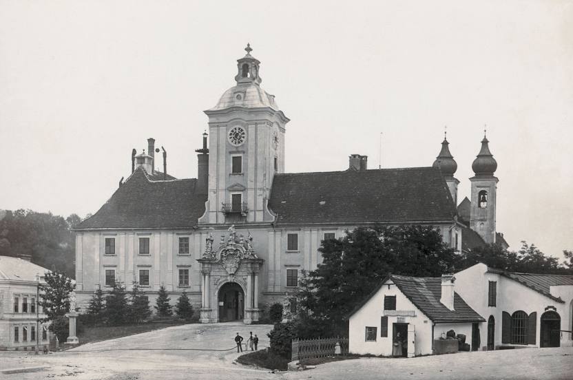
Photo
Where is located Lambach Abbey
Lambach Abbey — local attraction, which is located at Klosterpl. 1, 4650 Lambach, Austria and belongs to the category — monastery. Average visitor rating for this place — 4.4 (according to 207 ratings, information from open sources and relevant for 2022).
Exact location — Lambach Abbey, marked on the map with a red marker.
You can get directions to Lambach Abbey on the map from your location.
What else is interesting in Wels? You can see all the sights if you go to the city page.
Coordinates
Lambach Abbey, Austria coordinates in decimal format: latitude — 48.09123061522814, longitude — 13.875296307881579. When converted to degrees, minutes, seconds Lambach Abbey has the following coordinates: 48°5′28.43 north latitude and 13°52′31.07 east longitude.
Nearby cities
The largest cities that are located nearby:
- Linz — 24 km
- Salzburg — 83 km
- Graz — 161 km
- Regensburg
 (Germany) — 169 km
 - Pilsen
 (Czech Republic) — 180 km
 - Munich (Germany) — 181 km
- Ingolstadt (Germany) — 202 km
- Prague (Czech Republic) — 213 km
- Brno (Czech Republic) — 218 km
- Innsbruck — 221 km
- Bratislava
 (Slovakia) — 227 km
 - Augsburg (Germany) — 232 km
- Ljubljana
 (Slovenia) — 236 km
 - Nuremberg (Germany) — 256 km
- Fürth (Germany) — 263 km
- Erlangen (Germany) — 268 km
- Győr
 (Hungary) — 274 km
 - Trieste
 (Italy) — 279 km
 - Olomouc (Czech Republic) — 279 km
Distance to the capital
Distance to the capital (Vienna) is about — 186 km.