
 Pfarrwerfen
Rosenau am Hengstpaß
Grinzens
Sankt Martin am Wöllmißberg
Sankt Martin am Silberberg
Söding
Felixdorf
Oberpullendorf District
Fließ
Pfarrwerfen
Rosenau am Hengstpaß
Grinzens
Sankt Martin am Wöllmißberg
Sankt Martin am Silberberg
Söding
Felixdorf
Oberpullendorf District
Fließ
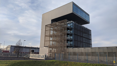
Voestalpine Stahlwelt - Ausstellung & Museum on the map, Linz, Austria
Photo
Where is located Voestalpine Stahlwelt - Ausstellung & Museum
Voestalpine Stahlwelt - Ausstellung & Museum — local attraction, which is located at voestalpine-Straße 4, 4020 Linz, Austria and belongs to the category — museum. Average visitor rating for this place — 4.6 (according to 1119 ratings, information from open sources and relevant for 2022).
Exact location — voestalpine Stahlwelt - Ausstellung & Museum, marked on the map with a red marker.
You can get directions to Voestalpine Stahlwelt - Ausstellung & Museum on the map from your location.
What else is interesting in Linz? You can see all the sights if you go to the city page.
Coordinates
voestalpine Stahlwelt - Ausstellung & Museum, Austria coordinates in decimal format: latitude — 48.27763944734848, longitude — 14.32042485788812. When converted to degrees, minutes, seconds voestalpine Stahlwelt - Ausstellung & Museum has the following coordinates: 48°16′39.5 north latitude and 14°19′13.53 east longitude.
Nearby cities
The largest cities that are located nearby:
- Salzburg — 107 km
- Graz — 162 km
- Pilsen
 (Czech Republic) — 171 km
 - Regensburg
 (Germany) — 177 km
 - Brno (Czech Republic) — 194 km
- Prague (Czech Republic) — 196 km
- Munich (Germany) — 200 km
- Bratislava
 (Slovakia) — 209 km
 - Ingolstadt (Germany) — 215 km
- Innsbruck — 245 km
- Augsburg (Germany) — 249 km
- Ljubljana
 (Slovenia) — 249 km
 - Olomouc (Czech Republic) — 256 km
- Győr
 (Hungary) — 260 km
 - Nuremberg (Germany) — 263 km
- Fürth (Germany) — 270 km
- Erlangen (Germany) — 274 km
- Chemnitz (Germany) — 295 km
- Trieste
 (Italy) — 296 km
Distance to the capital
Distance to the capital (Vienna) is about — 152 km.