 Herbertstown
Dromagh
Roughgrove
Millstreet
County Dublin
Athy
Sallins
Ballybunnion
Fethard
Herbertstown
Dromagh
Roughgrove
Millstreet
County Dublin
Athy
Sallins
Ballybunnion
Fethard
Portlick Millennium Forest on the map, Athlone, Ireland
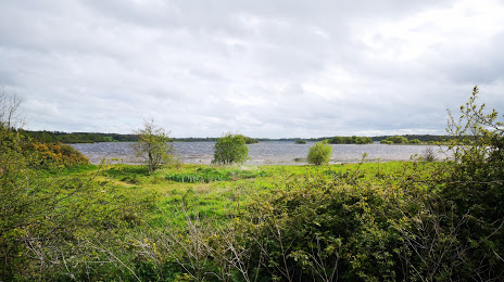
Photo
Where is located Portlick Millennium Forest
Portlick Millennium Forest — local attraction, which is located at Unnamed Road, Whinning, Co., Co. Westmeath, Ireland and belongs to the category — national forest. Average visitor rating for this place — 4.6 (according to 143 ratings, information from open sources and relevant for 2022).
Exact location — Portlick Millennium Forest, marked on the map with a red marker.
You can get directions to Portlick Millennium Forest on the map from your location.
What else is interesting in Athlone? You can see all the sights if you go to the city page.
Coordinates
Portlick Millennium Forest, Ireland coordinates in decimal format: latitude — 53.49546732390201, longitude — -7.911197853678996. When converted to degrees, minutes, seconds Portlick Millennium Forest has the following coordinates: 53°29′43.68 north latitude and -7°54′40.31 east longitude.
Nearby cities
The largest cities that are located nearby:
- Cork — 173 km
- Belfast
 (United Kingdom) — 183 km
 - Liverpool (United Kingdom) — 326 km
- Preston (United Kingdom) — 344 km
- Glasgow (United Kingdom) — 354 km
- Blackburn (United Kingdom) — 358 km
- Manchester (United Kingdom) — 375 km
- Telford (United Kingdom) — 378 km
- Stoke-on-Trent (United Kingdom) — 386 km
- Huddersfield (United Kingdom) — 404 km
- Edinburgh (United Kingdom) — 406 km
- Dudley (United Kingdom) — 407 km
- Worcester (Great Britain) — 411 km
- West Bromwich (United Kingdom) — 412 km
- Birmingham (United Kingdom) — 420 km
- Sutton Coldfield (United Kingdom) — 422 km
- Sheffield (United Kingdom) — 427 km
- Bristol (Great Britain) — 428 km
- Exeter (United Kingdom) — 430 km
Distance to the capital
Distance to the capital (Dublin) is about — 111 km.