 Herbertstown
Dromagh
Roughgrove
Millstreet
County Dublin
Athy
Sallins
Ballybunnion
Fethard
Herbertstown
Dromagh
Roughgrove
Millstreet
County Dublin
Athy
Sallins
Ballybunnion
Fethard
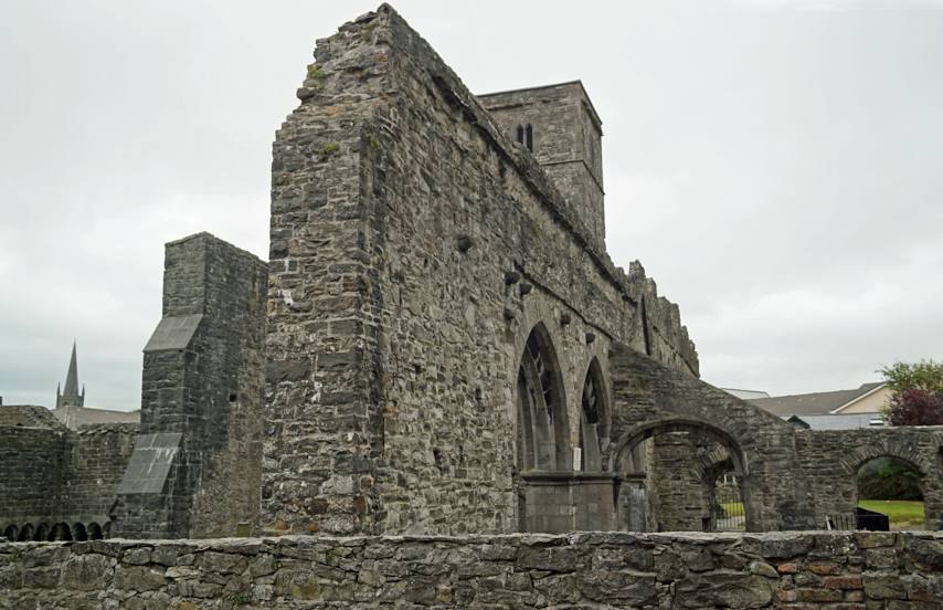
Sligo Abbey on the map, Sligo, Ireland
Photo
Where is located Sligo Abbey
Sligo Abbey — local attraction, which is located at Abbey St, Abbeyquarter North, Sligo, Ireland and belongs to the category — cloister. Average visitor rating for this place — 4.3 (according to 624 ratings, information from open sources and relevant for 2022).
Exact location — Sligo Abbey, marked on the map with a red marker.
You can get directions to Sligo Abbey on the map from your location.
What else is interesting in Sligo? You can see all the sights if you go to the city page.
Coordinates
Sligo Abbey, Ireland coordinates in decimal format: latitude — 54.27080725441373, longitude — -8.47008480176. When converted to degrees, minutes, seconds Sligo Abbey has the following coordinates: 54°16′14.91 north latitude and -8°28′12.31 east longitude.
Nearby cities
The largest cities that are located nearby:
- Belfast
 (United Kingdom) — 167 km
 - Cork — 263 km
- Glasgow (United Kingdom) — 315 km
- Liverpool (United Kingdom) — 374 km
- Edinburgh (United Kingdom) — 376 km
- Preston (United Kingdom) — 382 km
- Blackburn (United Kingdom) — 396 km
- Manchester (United Kingdom) — 419 km
- Telford (United Kingdom) — 441 km
- Stoke-on-Trent (United Kingdom) — 442 km
- Huddersfield (United Kingdom) — 444 km
- Sunderland (United Kingdom) — 456 km
- Dudley (United Kingdom) — 472 km
- Sheffield (United Kingdom) — 473 km
- West Bromwich (United Kingdom) — 477 km
- Rotherham (United Kingdom) — 478 km
- Worcester (Great Britain) — 482 km
- Sutton Coldfield (United Kingdom) — 485 km
- Birmingham (United Kingdom) — 486 km
Distance to the capital
Distance to the capital (Dublin) is about — 178 km.