
 Pfarrwerfen
Rosenau am Hengstpaß
Grinzens
Sankt Martin am Wöllmißberg
Sankt Martin am Silberberg
Söding
Felixdorf
Oberpullendorf District
Fließ
Pfarrwerfen
Rosenau am Hengstpaß
Grinzens
Sankt Martin am Wöllmißberg
Sankt Martin am Silberberg
Söding
Felixdorf
Oberpullendorf District
Fließ
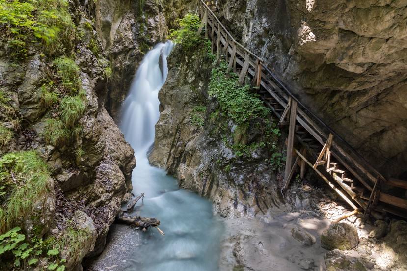
Wolfsklamm on the map, Schwaz, Austria
Photo
Where is located Wolfsklamm
Wolfsklamm — local attraction, which is located at Oberdorf 73, 6135 Stans, Austria and belongs to the category — tourist attraction. Average visitor rating for this place — 4.6 (according to 1617 ratings, information from open sources and relevant for 2022).
Exact location — Wolfsklamm, marked on the map with a red marker.
You can get directions to Wolfsklamm on the map from your location.
What else is interesting in Schwaz? You can see all the sights if you go to the city page.
Coordinates
Wolfsklamm, Austria coordinates in decimal format: latitude — 47.37396495078733, longitude — 11.702703097988936. When converted to degrees, minutes, seconds Wolfsklamm has the following coordinates: 47°22′26.27 north latitude and 11°42′9.73 east longitude.
Nearby cities
The largest cities that are located nearby:
- Innsbruck — 24 km
- Munich
 (Germany) — 87 km
 - Salzburg — 112 km
- Augsburg (Germany) — 127 km
- Trento
 (Italy) — 148 km
 - Ingolstadt (Germany) — 158 km
- Ulm (Germany) — 171 km
- Regensburg (Germany) — 186 km
- Vicenza (Italy) — 200 km
- Venice (Italy) — 216 km
- Linz — 217 km
- Verona (Italy) — 219 km
- Reutlingen (Germany) — 223 km
- Brescia (Italy) — 231 km
- Nuremberg (Germany) — 237 km
- Zurich
 (Switzerland) — 237 km
 - Bergamo (Italy) — 241 km
- Fürth (Germany) — 241 km
- Stuttgart (Germany) — 242 km
Distance to the capital
Distance to the capital (Vienna) is about — 361 km.