
 Pfarrwerfen
Rosenau am Hengstpaß
Grinzens
Sankt Martin am Wöllmißberg
Sankt Martin am Silberberg
Söding
Felixdorf
Oberpullendorf District
Fließ
Pfarrwerfen
Rosenau am Hengstpaß
Grinzens
Sankt Martin am Wöllmißberg
Sankt Martin am Silberberg
Söding
Felixdorf
Oberpullendorf District
Fließ
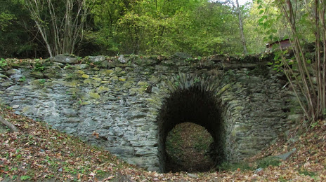
Römerbrücke on the map, Bruck an der Mur, Austria
Photo
Where is located Römerbrücke
Römerbrücke — local attraction, which is located at St. Dionysenstraße, 8600 Oberaich, Austria and belongs to the category — historical landmark. Average visitor rating for this place — 4.9 (according to 7 ratings, information from open sources and relevant for 2022).
Exact location — Römerbrücke, marked on the map with a red marker.
You can get directions to Römerbrücke on the map from your location.
What else is interesting in Bruck an der Mur? You can see all the sights if you go to the city page.
Coordinates
Römerbrücke, Austria coordinates in decimal format: latitude — 47.39668667554654, longitude — 15.298898140145349. When converted to degrees, minutes, seconds Römerbrücke has the following coordinates: 47°23′48.07 north latitude and 15°17′56.03 east longitude.
Nearby cities
The largest cities that are located nearby:
- Graz — 40 km
- Linz — 123 km
- Bratislava
 (Slovakia) — 158 km
 - Ljubljana
 (Slovenia) — 161 km
 - Salzburg — 170 km
- Győr
 (Hungary) — 180 km
 - Zagreb
 (Croatia) — 185 km
 - Brno
 (Czech Republic) — 220 km
 - Trieste
 (Italy) — 226 km
 - Székesfehérvár (Hungary) — 238 km
- Rijeka (Croatia) — 239 km
- Pécs (Hungary) — 271 km
- Olomouc (Czech Republic) — 280 km
- Budapest (Hungary) — 282 km
- Munich
 (Germany) — 284 km
 - Regensburg (Germany) — 290 km
- Innsbruck — 290 km
- Pilsen (Czech Republic) — 291 km
- Prague (Czech Republic) — 301 km
Distance to the capital
Distance to the capital (Vienna) is about — 121 km.