
 Pfarrwerfen
Rosenau am Hengstpaß
Grinzens
Sankt Martin am Wöllmißberg
Sankt Martin am Silberberg
Söding
Felixdorf
Oberpullendorf District
Fließ
Pfarrwerfen
Rosenau am Hengstpaß
Grinzens
Sankt Martin am Wöllmißberg
Sankt Martin am Silberberg
Söding
Felixdorf
Oberpullendorf District
Fließ
Esterházy Palace on the map, Eisenstadt, Austria
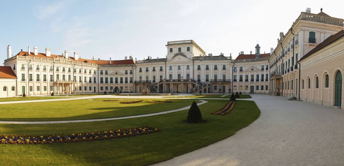
Photo
Where is located Esterházy Palace
Esterházy Palace — local attraction, which is located at Esterhazypl. 1, 7000 Eisenstadt, Austria and belongs to the category — palace. Average visitor rating for this place — 4.6 (according to 3446 ratings, information from open sources and relevant for 2022).
Exact location — Esterházy Palace, marked on the map with a red marker.
You can get directions to Esterházy Palace on the map from your location.
What else is interesting in Eisenstadt? You can see all the sights if you go to the city page.
Coordinates
Esterházy Palace, Austria coordinates in decimal format: latitude — 47.84622687738844, longitude — 16.519440398005358. When converted to degrees, minutes, seconds Esterházy Palace has the following coordinates: 47°50′46.42 north latitude and 16°31′9.99 east longitude.
Nearby cities
The largest cities that are located nearby:
- Bratislava
 (Slovakia) — 54 km
 - Győr
 (Hungary) — 85 km
 - Graz — 119 km
- Brno
 (Czech Republic) — 149 km
 - Székesfehérvár (Hungary) — 160 km
- Linz — 173 km
- Budapest (Hungary) — 192 km
- Olomouc (Czech Republic) — 200 km
- Zagreb
 (Croatia) — 228 km
 - Pécs (Hungary) — 236 km
- Ostrava (Czech Republic) — 251 km
- Ljubljana
 (Slovenia) — 251 km
 - Salzburg — 258 km
- Kecskemét (Hungary) — 261 km
- Bielsko-Biala
 (Poland) — 283 km
 - Rybnik (Poland) — 288 km
- Prague (Czech Republic) — 288 km
- Pilsen (Czech Republic) — 308 km
- Gliwice (Poland) — 310 km
Distance to the capital
Distance to the capital (Vienna) is about — 42 km.