
 Pfarrwerfen
Rosenau am Hengstpaß
Grinzens
Sankt Martin am Wöllmißberg
Sankt Martin am Silberberg
Söding
Felixdorf
Oberpullendorf District
Fließ
Pfarrwerfen
Rosenau am Hengstpaß
Grinzens
Sankt Martin am Wöllmißberg
Sankt Martin am Silberberg
Söding
Felixdorf
Oberpullendorf District
Fließ
Schilift Tschardun on the map, Rankweil, Austria
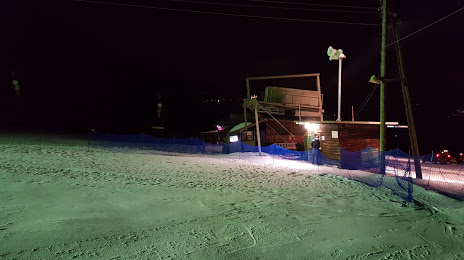
Photo
Where is located Schilift Tschardun
Schilift Tschardun — local attraction, which is located at 6710 Nenzing, Austria and belongs to the category — ski resort. Average visitor rating for this place — 4.9 (according to 27 ratings, information from open sources and relevant for 2022).
Exact location — Schilift Tschardun, marked on the map with a red marker.
You can get directions to Schilift Tschardun on the map from your location.
What else is interesting in Rankweil? You can see all the sights if you go to the city page.
Coordinates
Schilift Tschardun, Austria coordinates in decimal format: latitude — 47.18058833374222, longitude — 9.671035159605156. When converted to degrees, minutes, seconds Schilift Tschardun has the following coordinates: 47°10′50.12 north latitude and 9°40′15.73 east longitude.
Nearby cities
The largest cities that are located nearby:
- Zurich
 (Switzerland) — 83 km
 - Ulm
 (Germany) — 128 km
 - Innsbruck — 132 km
- Reutlingen (Germany) — 140 km
- Augsburg (Germany) — 153 km
- Freiburg (Germany) — 156 km
- Basel (Switzerland) — 156 km
- Bern (Switzerland) — 170 km
- Stuttgart (Germany) — 170 km
- Munich (Germany) — 172 km
- Bergamo
 (Italy) — 174 km
 - Trento (Italy) — 175 km
- Mulhouse
 (France) — 180 km
 - Monza (Italy) — 189 km
- Pforzheim (Germany) — 192 km
- Brescia (Italy) — 196 km
- Strasbourg (France) — 200 km
- Milan (Italy) — 203 km
- Heilbronn (Germany) — 209 km
Distance to the capital
Distance to the capital (Vienna) is about — 514 km.