
 Pfarrwerfen
Rosenau am Hengstpaß
Grinzens
Sankt Martin am Wöllmißberg
Sankt Martin am Silberberg
Söding
Felixdorf
Oberpullendorf District
Fließ
Pfarrwerfen
Rosenau am Hengstpaß
Grinzens
Sankt Martin am Wöllmißberg
Sankt Martin am Silberberg
Söding
Felixdorf
Oberpullendorf District
Fließ
Nordkette Cable Car on the map, Innsbruck, Austria
Photo
Where is located Nordkette Cable Car
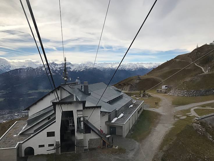
Nordkette Cable Car — local attraction, which is located at Rennweg 3, 6020 Innsbruck, Austria and belongs to the category — ski area. Average visitor rating for this place — 4.6 (according to 2681 rating, information from open sources and relevant for 2022).
Exact location — Nordkette Cable Car, marked on the map with a red marker.
You can get directions to Nordkette Cable Car on the map from your location.
What else is interesting in Innsbruck? You can see all the sights if you go to the city page.
Coordinates
Nordkette Cable Car, Austria coordinates in decimal format: latitude — 47.270204380101454, longitude — 11.39519125960819. When converted to degrees, minutes, seconds Nordkette Cable Car has the following coordinates: 47°16′12.74 north latitude and 11°23′42.69 east longitude.
Nearby cities
The largest cities that are located nearby:
- Munich
 (Germany) — 97 km
 - Augsburg (Germany) — 127 km
- Trento
 (Italy) — 134 km
 - Salzburg — 136 km
- Ulm (Germany) — 163 km
- Ingolstadt (Germany) — 166 km
- Vicenza (Italy) — 191 km
- Regensburg (Germany) — 199 km
- Verona (Italy) — 205 km
- Reutlingen (Germany) — 211 km
- Brescia (Italy) — 212 km
- Venice (Italy) — 214 km
- Zurich
 (Switzerland) — 215 km
 - Bergamo (Italy) — 219 km
- Stuttgart (Germany) — 232 km
- Linz — 241 km
- Nuremberg (Germany) — 242 km
- Fürth (Germany) — 246 km
- Monza (Italy) — 249 km
Distance to the capital
Distance to the capital (Vienna) is about — 387 km.