
 Gilserberg
Berlin
Bordesholm
Bechtolsheim
Aub
Triptis
Heppenheim
Biblis
Angermünde
Gilserberg
Berlin
Bordesholm
Bechtolsheim
Aub
Triptis
Heppenheim
Biblis
Angermünde
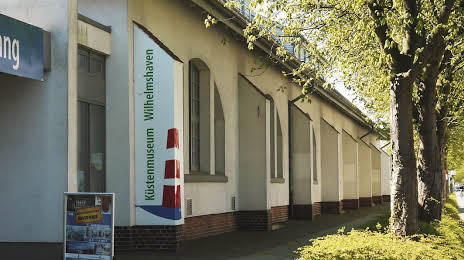
Küstenmuseum Wilhelmshaven on the map, Wilhelmshaven, Germany
Photo
Where is located Küstenmuseum Wilhelmshaven
Küstenmuseum Wilhelmshaven — local attraction, which is located at Weserstraße 58, 26382 Wilhelmshaven, Germany and belongs to the category — museum. Average visitor rating for this place — 4.4 (according to 319 ratings, information from open sources and relevant for 2022).
Exact location — Küstenmuseum Wilhelmshaven, marked on the map with a red marker.
You can get directions to Küstenmuseum Wilhelmshaven on the map from your location.
What else is interesting in Wilhelmshaven? You can see all the sights if you go to the city page.
Coordinates
Küstenmuseum Wilhelmshaven, Germany coordinates in decimal format: latitude — 53.515203590861, longitude — 8.12478055983413. When converted to degrees, minutes, seconds Küstenmuseum Wilhelmshaven has the following coordinates: 53°30′54.73 north latitude and 8°7′29.21 east longitude.
Nearby cities
The largest cities that are located nearby:
- Bremerhaven — 31 km
- Bremen — 68 km
- Groningen
 (Netherlands) — 108 km
 - Emmen (Netherlands) — 116 km
- Osnabrück — 139 km
- Kiel — 157 km
- Enschede (Netherlands) — 167 km
- Hanover — 168 km
- Bielefeld — 169 km
- Zwolle (Netherlands) — 176 km
- Münster — 177 km
- Hildesheim — 197 km
- Paderborn — 205 km
- Apeldoorn (Netherlands) — 206 km
- Hamm — 206 km
- Salzgitter — 215 km
- Brunswick — 215 km
- Wolfsburg — 218 km
- Recklinghausen — 221 km
Distance to the capital
Distance to the capital (Berlin) is about — 370 km.