
 Pfarrwerfen
Rosenau am Hengstpaß
Grinzens
Sankt Martin am Wöllmißberg
Sankt Martin am Silberberg
Söding
Felixdorf
Oberpullendorf District
Fließ
Pfarrwerfen
Rosenau am Hengstpaß
Grinzens
Sankt Martin am Wöllmißberg
Sankt Martin am Silberberg
Söding
Felixdorf
Oberpullendorf District
Fließ
Strandbad Burgstaller on the map, Spittal an der Drau, Austria
Photo
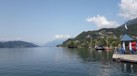
Where is located Strandbad Burgstaller
Strandbad Burgstaller — local attraction, which is located at no data and belongs to the category — -. Average visitor rating for this place — 3.8 (according to 14 ratings, information from open sources and relevant for 2022).
Exact location — Strandbad Burgstaller, marked on the map with a red marker.
You can get directions to Strandbad Burgstaller on the map from your location.
What else is interesting in Spittal an der Drau? You can see all the sights if you go to the city page.
Coordinates
Strandbad Burgstaller, Austria coordinates in decimal format: latitude — 46.770220110187566, longitude — 13.645665959590993. When converted to degrees, minutes, seconds Strandbad Burgstaller has the following coordinates: 46°46′12.79 north latitude and 13°38′44.4 east longitude.
Nearby cities
The largest cities that are located nearby:
- Ljubljana
 (Slovenia) — 113 km
 - Salzburg — 116 km
- Trieste
 (Italy) — 129 km
 - Graz — 150 km
- Innsbruck — 165 km
- Venice (Italy) — 176 km
- Linz — 177 km
- Rijeka
 (Croatia) — 179 km
 - Trento (Italy) — 199 km
- Munich
 (Germany) — 204 km
 - Vicenza (Italy) — 205 km
- Zagreb (Croatia) — 221 km
- Verona (Italy) — 246 km
- Augsburg (Germany) — 258 km
- Ferrara (Italy) — 262 km
- Ingolstadt (Germany) — 265 km
- Regensburg (Germany) — 265 km
- Ravenna (Italy) — 282 km
- Brescia (Italy) — 290 km
Distance to the capital
Distance to the capital (Vienna) is about — 260 km.