
 Pfarrwerfen
Rosenau am Hengstpaß
Grinzens
Sankt Martin am Wöllmißberg
Sankt Martin am Silberberg
Söding
Felixdorf
Oberpullendorf District
Fließ
Pfarrwerfen
Rosenau am Hengstpaß
Grinzens
Sankt Martin am Wöllmißberg
Sankt Martin am Silberberg
Söding
Felixdorf
Oberpullendorf District
Fließ
Ländle SUP on the map, Bregenz, Austria
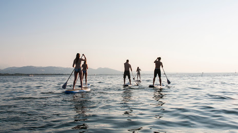
Photo
Where is located Ländle SUP
Ländle SUP — local attraction, which is located at Am Kaiserstrand, 6911 Lochau, Austria and belongs to the category — sports school. Average visitor rating for this place — 4.9 (according to 24 ratings, information from open sources and relevant for 2022).
Exact location — Ländle SUP, marked on the map with a red marker.
You can get directions to Ländle SUP on the map from your location.
What else is interesting in Bregenz? You can see all the sights if you go to the city page.
Coordinates
Ländle SUP, Austria coordinates in decimal format: latitude — 47.52581568474651, longitude — 9.746504859617064. When converted to degrees, minutes, seconds Ländle SUP has the following coordinates: 47°31′32.94 north latitude and 9°44′47.42 east longitude.
Nearby cities
The largest cities that are located nearby:
- Zurich
 (Switzerland) — 91 km
 - Ulm
 (Germany) — 101 km
 - Reutlingen (Germany) — 118 km
- Innsbruck — 127 km
- Augsburg (Germany) — 128 km
- Stuttgart (Germany) — 147 km
- Freiburg (Germany) — 151 km
- Munich (Germany) — 153 km
- Basel (Switzerland) — 160 km
- Pforzheim (Germany) — 172 km
- Mulhouse
 (France) — 181 km
 - Bern (Switzerland) — 184 km
- Heilbronn (Germany) — 186 km
- Ingolstadt (Germany) — 186 km
- Strasbourg (France) — 188 km
- Trento
 (Italy) — 190 km
 - Karlsruhe (Germany) — 193 km
- Bergamo (Italy) — 199 km
- Monza (Italy) — 215 km
Distance to the capital
Distance to the capital (Vienna) is about — 500 km.