
 Pfarrwerfen
Rosenau am Hengstpaß
Grinzens
Sankt Martin am Wöllmißberg
Sankt Martin am Silberberg
Söding
Felixdorf
Oberpullendorf District
Fließ
Pfarrwerfen
Rosenau am Hengstpaß
Grinzens
Sankt Martin am Wöllmißberg
Sankt Martin am Silberberg
Söding
Felixdorf
Oberpullendorf District
Fließ
Rauch's Radiomuseum on the map, Lustenau, Austria
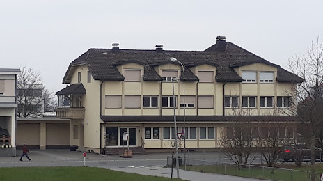
Photo
Where is located Rauch's Radiomuseum
Rauch's Radiomuseum — local attraction, which is located at Hofsteigstraße 21, 6890 Lustenau, Austria and belongs to the category — history museum. Average visitor rating for this place — 5.0 (according to 3 ratings, information from open sources and relevant for 2022).
Exact location — Rauch's Radiomuseum, marked on the map with a red marker.
You can get directions to Rauch's Radiomuseum on the map from your location.
What else is interesting in Lustenau? You can see all the sights if you go to the city page.
Coordinates
Rauch's Radiomuseum, Austria coordinates in decimal format: latitude — 47.436074037025776, longitude — 9.662286159613913. When converted to degrees, minutes, seconds Rauch's Radiomuseum has the following coordinates: 47°26′9.87 north latitude and 9°39′44.23 east longitude.
Nearby cities
The largest cities that are located nearby:
- Zurich
 (Switzerland) — 84 km
 - Ulm
 (Germany) — 111 km
 - Reutlingen (Germany) — 125 km
- Innsbruck — 132 km
- Augsburg (Germany) — 139 km
- Freiburg (Germany) — 149 km
- Stuttgart (Germany) — 154 km
- Basel (Switzerland) — 155 km
- Munich (Germany) — 162 km
- Bern (Switzerland) — 175 km
- Mulhouse
 (France) — 177 km
 - Pforzheim (Germany) — 177 km
- Trento
 (Italy) — 187 km
 - Strasbourg (France) — 189 km
- Bergamo (Italy) — 190 km
- Heilbronn (Germany) — 193 km
- Ingolstadt (Germany) — 197 km
- Karlsruhe (Germany) — 198 km
- Monza (Italy) — 205 km
Distance to the capital
Distance to the capital (Vienna) is about — 508 km.