
 Pfarrwerfen
Rosenau am Hengstpaß
Grinzens
Sankt Martin am Wöllmißberg
Sankt Martin am Silberberg
Söding
Felixdorf
Oberpullendorf District
Fließ
Pfarrwerfen
Rosenau am Hengstpaß
Grinzens
Sankt Martin am Wöllmißberg
Sankt Martin am Silberberg
Söding
Felixdorf
Oberpullendorf District
Fließ
Forsteralm Skilifte on the map, Waidhofen an der Ybbs, Austria
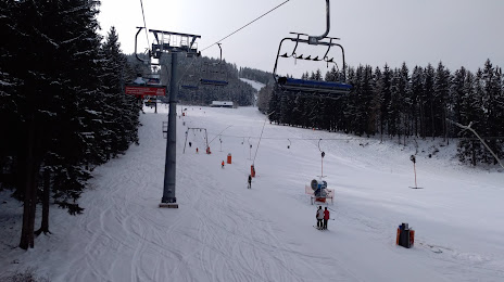
Photo
Where is located Forsteralm Skilifte
Forsteralm Skilifte — local attraction, which is located at Oberland 73/2, 3334 Gaflenz, Austria and belongs to the category — ski resort. Average visitor rating for this place — 4.5 (according to 185 ratings, information from open sources and relevant for 2022).
Exact location — Forsteralm Skilifte, marked on the map with a red marker.
You can get directions to Forsteralm Skilifte on the map from your location.
What else is interesting in Waidhofen an der Ybbs? You can see all the sights if you go to the city page.
Coordinates
Forsteralm Skilifte, Austria coordinates in decimal format: latitude — 47.89931441074948, longitude — 14.75542382519009. When converted to degrees, minutes, seconds Forsteralm Skilifte has the following coordinates: 47°53′57.53 north latitude and 14°45′19.53 east longitude.
Nearby cities
The largest cities that are located nearby:
- Linz — 52 km
- Graz — 110 km
- Salzburg — 129 km
- Bratislava
 (Slovakia) — 173 km
 - Brno
 (Czech Republic) — 190 km
 - Ljubljana
 (Slovenia) — 211 km
 - Győr
 (Hungary) — 216 km
 - Pilsen (Czech Republic) — 221 km
- Regensburg
 (Germany) — 226 km
 - Prague (Czech Republic) — 235 km
- Munich (Germany) — 236 km
- Olomouc (Czech Republic) — 253 km
- Zagreb
 (Croatia) — 255 km
 - Ingolstadt (Germany) — 260 km
- Innsbruck — 264 km
- Trieste
 (Italy) — 267 km
 - Székesfehérvár (Hungary) — 287 km
- Augsburg (Germany) — 288 km
- Rijeka (Croatia) — 292 km
Distance to the capital
Distance to the capital (Vienna) is about — 125 km.