
 Puerto de la Duquesa
La Serna de Iguña
Pumalverde
Puentenansa
La Iglesia
Casar de Periedo
Fuengirola
Renedo de Piélagos
Villabanez
Puerto de la Duquesa
La Serna de Iguña
Pumalverde
Puentenansa
La Iglesia
Casar de Periedo
Fuengirola
Renedo de Piélagos
Villabanez
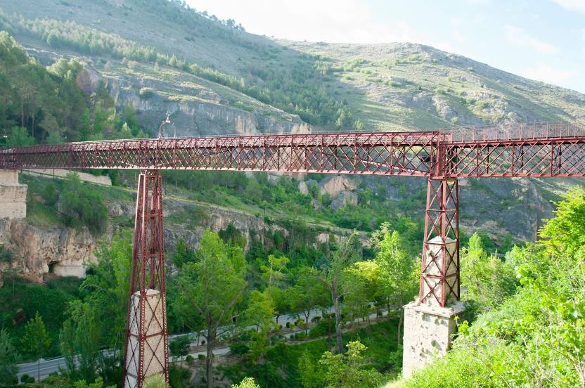
San Pablo Bridge (Puente de San Pablo) on the map, Cuenca, Spain
Photo
Where is located San Pablo Bridge (Puente de San Pablo)
San Pablo Bridge (Puente de San Pablo) — local attraction, which is located at Río Huécar, Cuenca, Cuenca, Spain and belongs to the category — bridge. Average visitor rating for this place — 4.6 (according to 2361 rating, information from open sources and relevant for 2022).
Exact location — San Pablo Bridge (Puente de San Pablo), marked on the map with a red marker.
You can get directions to San Pablo Bridge (Puente de San Pablo) on the map from your location.
What else is interesting in Cuenca? You can see all the sights if you go to the city page.
Coordinates
San Pablo Bridge (Puente de San Pablo), Spain coordinates in decimal format: latitude — 40.078251537391644, longitude — -2.127585875064938. When converted to degrees, minutes, seconds San Pablo Bridge (Puente de San Pablo) has the following coordinates: 40°4′41.71 north latitude and -2°7′39.31 east longitude.
Nearby cities
The largest cities that are located nearby:
- Alcala de Henares — 113 km
- Torrejón de Ardoz — 120 km
- Albacete — 121 km
- Alcobendas — 136 km
- Getafe — 137 km
- Leganés — 140 km
- Fuenlabrada — 143 km
- Alcorcón — 146 km
- Móstoles — 149 km
- Valencia — 164 km
- Zaragoza — 203 km
- Murcia — 246 km
- Logroño — 266 km
- Valladolid — 276 km
- Burgos — 282 km
- Lleida — 285 km
- Cartagena — 288 km
- Jaén — 291 km
- Tarragona — 305 km
Distance to the capital
Distance to the capital (Madrid) is about — 139 km.