 Betteshanger
Lynton
Amesbury
Marlow
Burford
Chipping Norton
Marlborough
Cairnryan
Lydney
Betteshanger
Lynton
Amesbury
Marlow
Burford
Chipping Norton
Marlborough
Cairnryan
Lydney
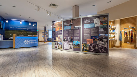
Discover Ulster-Scots Centre on the map, Belfast, United Kingdom
Photo
Where is located Discover Ulster-Scots Centre
Discover Ulster-Scots Centre — local attraction, which is located at 1, 9 Victoria St, Belfast BT1 3GA, United Kingdom and belongs to the category — visitor center. Average visitor rating for this place — 4.7 (according to 28 ratings, information from open sources and relevant for 2022).
Exact location — Discover Ulster-Scots Centre, marked on the map with a red marker.
You can get directions to Discover Ulster-Scots Centre on the map from your location.
What else is interesting in Belfast? You can see all the sights if you go to the city page.
Coordinates
Discover Ulster-Scots Centre, United Kingdom coordinates in decimal format: latitude — 54.60193401404256, longitude — -5.925368374564424. When converted to degrees, minutes, seconds Discover Ulster-Scots Centre has the following coordinates: 54°36′6.96 north latitude and -5°55′31.33 east longitude.
Nearby cities
The largest cities that are located nearby:
- Dublin
 (Ireland) — 140 km
 - Glasgow — 175 km
- Edinburgh — 226 km
- Preston — 230 km
- Liverpool — 234 km
- Blackburn — 244 km
- Manchester — 272 km
- Sunderland — 291 km
- Huddersfield — 291 km
- Stoke-on-Trent — 306 km
- Telford — 316 km
- Sheffield — 323 km
- Rotherham — 327 km
- Cork (Ireland) — 346 km
- Dudley — 347 km
- West Bromwich — 351 km
- Sutton Coldfield — 355 km
- Birmingham — 358 km
- Worcester — 366 km
Distance to the capital
Distance to the capital (London) is about — 518 km.