

Lotus Temple on the map, New Delhi, India
Photo
Where is located Lotus Temple
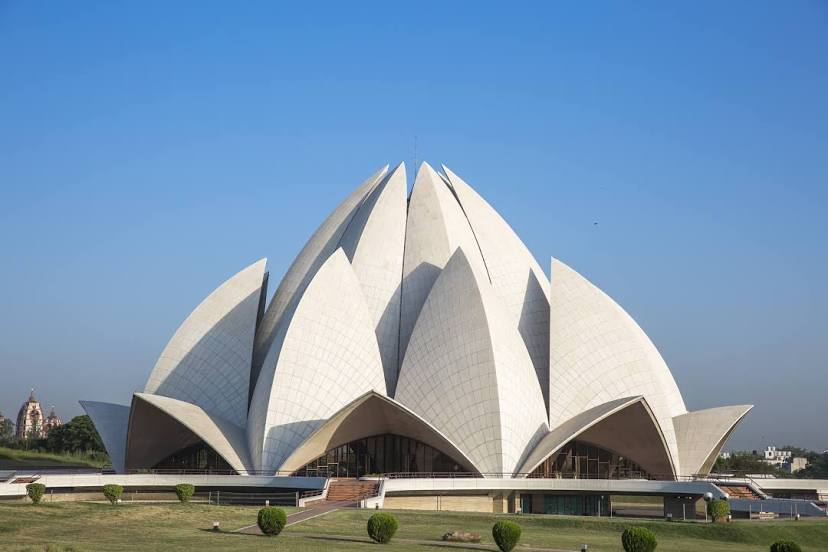
Lotus Temple — local attraction, which is located at Lotus Temple Rd, Bahapur, Shambhu Dayal Bagh, Kalkaji, New Delhi, Delhi 110019, India and belongs to the category — baháʼí house of worship. Average visitor rating for this place — 4.5 (according to 40812 ratings, information from open sources and relevant for 2022).
Exact location — Lotus Temple, marked on the map with a red marker.
You can get directions to Lotus Temple on the map from your location.
What else is interesting in New Delhi? You can see all the sights if you go to the city page.
Coordinates
Lotus Temple, India coordinates in decimal format: latitude — 28.55344957488613, longitude — 77.25876202463029. When converted to degrees, minutes, seconds Lotus Temple has the following coordinates: 28°33′12.42 north latitude and 77°15′31.54 east longitude.
Nearby cities
The largest cities that are located nearby:
- North West Delhi — 12 km
- Delhi — 14 km
- Noida — 20 km
- Ghaziabad — 25 km
- Gurgaon — 25 km
- Faridabad — 25 km
- Meerut — 63 km
- Rohtak — 68 km
- Rewari — 75 km
- Karnal — 120 km
- Alwar — 130 km
- Mathura — 132 km
- Roorkee — 152 km
- Saharanpur — 153 km
- Moradabad — 154 km
- Hisar — 155 km
- Bharatpur — 157 km
- Haridwar — 173 km
- Gorakhpur — 174 km