

Devi Talab Mandir on the map, Jalandhar, India
Photo
Where is located Devi Talab Mandir
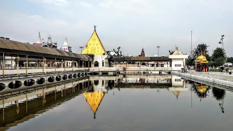
Devi Talab Mandir — local attraction, which is located at Tanda Rd, Shiv Nagar, Industrial Area, Jalandhar, Punjab 144004, India and belongs to the category — hindu temple. Average visitor rating for this place — 4.7 (according to 10398 ratings, information from open sources and relevant for 2022).
Exact location — Devi Talab Mandir, marked on the map with a red marker.
You can get directions to Devi Talab Mandir on the map from your location.
What else is interesting in Jalandhar? You can see all the sights if you go to the city page.
Coordinates
Devi Talab Mandir, India coordinates in decimal format: latitude — 31.343505947426582, longitude — 75.58271252469567. When converted to degrees, minutes, seconds Devi Talab Mandir has the following coordinates: 31°20′36.62 north latitude and 75°34′57.77 east longitude.
Nearby cities
The largest cities that are located nearby:
- Phagwara — 22 km
- Ludhiana — 54 km
- Batala — 65 km
- Moga — 68 km
- Amritsar — 75 km
- Pathankot — 104 km
- Barnala — 104 km
- Kasur
 (Pakistan) — 109 km
 - Lahore (Pakistan) — 118 km
- Chandigarh — 132 km
- Patiala — 133 km
- Muridke (Pakistan) — 135 km
- Shimla — 153 km
- Ambala — 155 km
- Sheikhupura (Pakistan) — 156 km
- Daska (Pakistan) — 159 km
- Gujranwala (Pakistan) — 159 km
- Siālkot (Pakistan) — 162 km
- Jammu — 169 km
Distance to the capital
Distance to the capital (New Delhi) is about — 342 km.