

Howrah Bridge on the map, Kolkata, India
Photo
Where is located Howrah Bridge
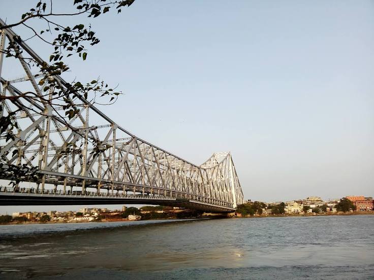
Howrah Bridge — local attraction, which is located at Howrah, West Bengal 700001, India and belongs to the category — cantilever bridge. Average visitor rating for this place — 4.6 (according to 71875 ratings, information from open sources and relevant for 2022).
Exact location — Howrah Bridge, marked on the map with a red marker.
You can get directions to Howrah Bridge on the map from your location.
What else is interesting in Kolkata? You can see all the sights if you go to the city page.
Coordinates
Howrah Bridge, India coordinates in decimal format: latitude — 22.585072107982132, longitude — 88.34706372450921. When converted to degrees, minutes, seconds Howrah Bridge has the following coordinates: 22°35′6.26 north latitude and 88°20′49.43 east longitude.
Nearby cities
The largest cities that are located nearby:
- Haldia — 64 km
- Jessore
 (Bangladesh) — 107 km
 - Medinipur — 108 km
- Khulna (Bangladesh) — 124 km
- Durgapur — 150 km
- Kushtia (Bangladesh) — 165 km
- Pabna (Bangladesh) — 181 km
- Asansol — 185 km
- Faridpur (Bangladesh) — 188 km
- Rajshahi (Bangladesh) — 200 km
- Barisal (Bangladesh) — 203 km
- Jamshedpur — 222 km
- Nagarpur (Bangladesh) — 224 km
- Tangail (Bangladesh) — 242 km
- Narayanganj (Bangladesh) — 245 km
- Dhaka (Bangladesh) — 248 km
- Bogra (Bangladesh) — 271 km
- Narsingdi (Bangladesh) — 281 km
- Comilla (Bangladesh) — 304 km
Distance to the capital
Distance to the capital (New Delhi) is about — 1302 km.