

Thirunakkara Mahadeva Temple on the map, Kottayam, India
Photo
Where is located Thirunakkara Mahadeva Temple
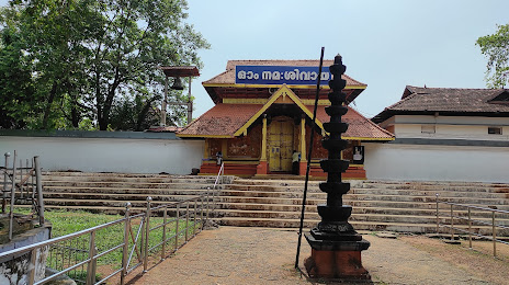
Thirunakkara Mahadeva Temple — local attraction, which is located at Temple Rd, Thirunakara, Kottayam, Kerala 686001, India and belongs to the category — hindu temple. Average visitor rating for this place — 4.7 (according to 2891 rating, information from open sources and relevant for 2022).
Exact location — Thirunakkara Mahadeva Temple, marked on the map with a red marker.
You can get directions to Thirunakkara Mahadeva Temple on the map from your location.
What else is interesting in Kottayam? You can see all the sights if you go to the city page.
Coordinates
Thirunakkara Mahadeva Temple, India coordinates in decimal format: latitude — 9.590363988129296, longitude — 76.51871592434026. When converted to degrees, minutes, seconds Thirunakkara Mahadeva Temple has the following coordinates: 9°35′25.31 north latitude and 76°31′7.38 east longitude.
Nearby cities
The largest cities that are located nearby:
- Alappuzha — 23 km
- Kochi — 47 km
- Kollam — 78 km
- Thrissur — 109 km
- Thiruvananthapuram — 126 km
- Palakkad — 133 km
- Coimbatore — 164 km
- Tirunelveli — 166 km
- Madurai — 178 km
- Nagercoil — 184 km
- Tiruppur — 190 km
- Kozhikode — 201 km
- Erode — 230 km
- Tiruchirappalli — 272 km
- Salem — 289 km
- Thanjavur — 313 km
- Kumbakonam — 346 km
- Hosur — 373 km
- Hassan — 380 km
Distance to the capital
Distance to the capital (New Delhi) is about — 2117 km.