

Bibi Ka Maqbara on the map, Aurangabad, India
Photo
Where is located Bibi Ka Maqbara
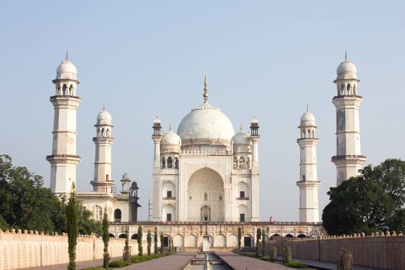
Bibi Ka Maqbara — local attraction, which is located at Begumpura, Aurangabad, Maharashtra 431004, India and belongs to the category — tomb. Average visitor rating for this place — 4.2 (according to 23864 ratings, information from open sources and relevant for 2022).
Exact location — Bibi Ka Maqbara, marked on the map with a red marker.
You can get directions to Bibi Ka Maqbara on the map from your location.
What else is interesting in Aurangabad? You can see all the sights if you go to the city page.
Coordinates
Bibi Ka Maqbara, India coordinates in decimal format: latitude — 19.90115874007236, longitude — 75.32019077446353. When converted to degrees, minutes, seconds Bibi Ka Maqbara has the following coordinates: 19°54′4.17 north latitude and 75°19′12.69 east longitude.
Nearby cities
The largest cities that are located nearby:
- Jalna — 56 km
- Ahmednagar — 106 km
- Nashik — 162 km
- Akola — 194 km
- Pune — 216 km
- Ulhasnagar — 239 km
- Khandwa — 239 km
- Solapur — 252 km
- Thane — 257 km
- Navi Mumbai — 259 km
- Virar — 269 km
- Achalpur — 270 km
- Mumbai — 272 km
- Surat — 296 km
- Bharuch — 315 km
- Bidar — 315 km
- Indore — 319 km
- Sangli — 344 km
- Vadodara — 348 km
Distance to the capital
Distance to the capital (New Delhi) is about — 988 km.