

Maharaja Ranjit Singh Fort on the map, Ludhiana, India
Photo
Where is located Maharaja Ranjit Singh Fort
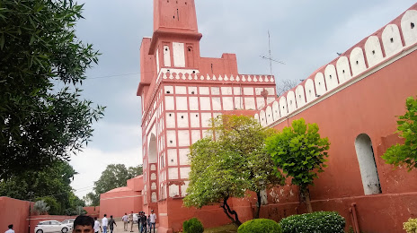
Maharaja Ranjit Singh Fort — local attraction, which is located at 2Q6Q+PHM, Punjab Police Academy Campus, Phillaur, Punjab 144410, India and belongs to the category — historical place. Average visitor rating for this place — 4.5 (according to 873 ratings, information from open sources and relevant for 2022).
Exact location — Maharaja Ranjit Singh Fort, marked on the map with a red marker.
You can get directions to Maharaja Ranjit Singh Fort on the map from your location.
What else is interesting in Ludhiana? You can see all the sights if you go to the city page.
Coordinates
Maharaja Ranjit Singh Fort, India coordinates in decimal format: latitude — 30.984106177290872, longitude — 75.80482489104382. When converted to degrees, minutes, seconds Maharaja Ranjit Singh Fort has the following coordinates: 30°59′2.78 north latitude and 75°48′17.37 east longitude.
Nearby cities
The largest cities that are located nearby:
- Phagwara — 37 km
- Jalandhar — 54 km
- Barnala — 65 km
- Moga — 66 km
- Patiala — 80 km
- Chandigarh — 90 km
- Ambala — 105 km
- Batala — 118 km
- Amritsar — 123 km
- Shimla — 127 km
- Kasur
 (Pakistan) — 135 km
 - Pathankot — 152 km
- Lahore (Pakistan) — 159 km
- Gorakhpur — 162 km
- Sirsa — 171 km
- Karnal — 173 km
- Muridke (Pakistan) — 180 km
- Saharanpur — 192 km
- Hisar — 194 km
Distance to the capital
Distance to the capital (New Delhi) is about — 296 km.