

Konganagiri Murugan Temple on the map, Tiruppur, India
Photo
Where is located Konganagiri Murugan Temple
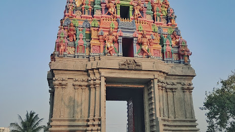
Konganagiri Murugan Temple — local attraction, which is located at College Rd, Konganagiri Rd, Konganagiri, Tiruppur, Tamil Nadu 641602, India and belongs to the category — hindu temple. Average visitor rating for this place — 4.6 (according to 695 ratings, information from open sources and relevant for 2022).
Exact location — Konganagiri Murugan Temple, marked on the map with a red marker.
You can get directions to Konganagiri Murugan Temple on the map from your location.
What else is interesting in Tiruppur? You can see all the sights if you go to the city page.
Coordinates
Konganagiri Murugan Temple, India coordinates in decimal format: latitude — 11.110377517207972, longitude — 77.31508522435308. When converted to degrees, minutes, seconds Konganagiri Murugan Temple has the following coordinates: 11°6′37.36 north latitude and 77°18′54.31 east longitude.
Nearby cities
The largest cities that are located nearby:
- Coimbatore — 43 km
- Erode — 45 km
- Palakkad — 83 km
- Salem — 107 km
- Thrissur — 138 km
- Tiruchirappalli — 152 km
- Madurai — 156 km
- Kozhikode — 170 km
- Kochi — 175 km
- Hosur — 186 km
- Thanjavur — 198 km
- Alappuzha — 209 km
- Kumbakonam — 223 km
- Tiruvannamalai — 224 km
- Kolar — 240 km
- Hassan — 249 km
- Kollam — 257 km
- Tirunelveli — 269 km
- Cuddalore — 270 km
Distance to the capital
Distance to the capital (New Delhi) is about — 1947 km.