

Domes de Fabedougou on the map, Banfora, Burkina Faso
Photo
Where is located Domes de Fabedougou
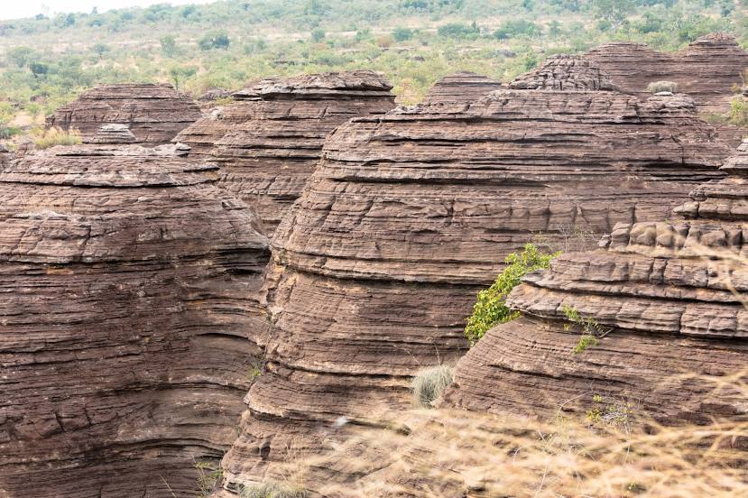
Domes de Fabedougou — local attraction, which is located at P5GR+393, Karfiguela, Burkina Faso and belongs to the category — tourist attraction. Average visitor rating for this place — 4.6 (according to 93 ratings, information from open sources and relevant for 2022).
Exact location — Domes de Fabedougou, marked on the map with a red marker.
You can get directions to Domes de Fabedougou on the map from your location.
What else is interesting in Banfora? You can see all the sights if you go to the city page.
Coordinates
Domes de Fabedougou, Burkina Faso coordinates in decimal format: latitude — 10.725080855977177, longitude — -4.809157875650232. When converted to degrees, minutes, seconds Domes de Fabedougou has the following coordinates: 10°43′30.29 north latitude and -4°48′32.97 east longitude.
Nearby cities
The largest cities that are located nearby:
- Bobo-Dioulasso — 79 km
- Sikasso
 (Mali) — 124 km
 - Korhogo
 (Ivory Coast) — 160 km
 - Bouake (Côte d'Ivoire) — 328 km
- Bamako (Mali) — 414 km
- Yamoussoukro (Côte d'Ivoire) — 427 km
- Mopti (Mali) — 430 km
- Tamale
 (Ghana) — 447 km
 - Abengourou (Côte d'Ivoire) — 454 km
- Daloa (Côte d'Ivoire) — 455 km
- Man (Côte d'Ivoire) — 471 km
- Kankan Prefecture
 (Guinea) — 496 km
 - Gagnoa (Ivory Coast) — 513 km
- Divo (Côte d'Ivoire) — 535 km
- Nzerekore (Guinea) — 547 km
- Kumasi (Ghana) — 559 km
- Abidjan (Côte d'Ivoire) — 594 km
- Obuasi (Ghana) — 595 km
- Kara
 (Togo) — 661 km
Distance to the capital
Distance to the capital (Ouagadougou) is about — 402 km.