 Betteshanger
Lynton
Amesbury
Marlow
Burford
Chipping Norton
Marlborough
Cairnryan
Lydney
Betteshanger
Lynton
Amesbury
Marlow
Burford
Chipping Norton
Marlborough
Cairnryan
Lydney
Daventry & District Golf Club on the map, Daventry, United Kingdom
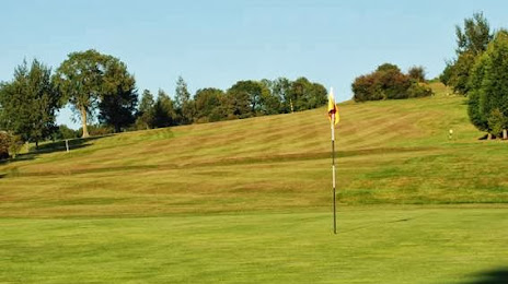
Photo
Where is located Daventry & District Golf Club
Daventry & District Golf Club — local attraction, which is located at Unnamed Road, Daventry NN11 2LS, United Kingdom and belongs to the category — golf club. Average visitor rating for this place — 4.5 (according to 85 ratings, information from open sources and relevant for 2022).
Exact location — Daventry & District Golf Club, marked on the map with a red marker.
You can get directions to Daventry & District Golf Club on the map from your location.
What else is interesting in Daventry? You can see all the sights if you go to the city page.
Coordinates
Daventry & District Golf Club, United Kingdom coordinates in decimal format: latitude — 52.26370984554351, longitude — -1.1666074876752968. When converted to degrees, minutes, seconds Daventry & District Golf Club has the following coordinates: 52°15′49.36 north latitude and -1°9′59.79 east longitude.
Nearby cities
The largest cities that are located nearby:
- Northampton — 18 km
- Coventry — 29 km
- Leicester — 42 km
- Birmingham — 55 km
- Sutton Coldfield — 56 km
- Oxford — 56 km
- West Bromwich — 63 km
- Luton — 66 km
- Dudley — 68 km
- Worcester — 72 km
- Cheltenham — 74 km
- Watford — 85 km
- Cambridge — 87 km
- Swindon — 88 km
- Reading — 90 km
- Slough — 91 km
- Telford — 98 km
- Stoke-on-Trent — 107 km
- Sutton — 120 km
Distance to the capital
Distance to the capital (London) is about — 110 km.