 Betteshanger
Lynton
Amesbury
Marlow
Burford
Chipping Norton
Marlborough
Cairnryan
Lydney
Betteshanger
Lynton
Amesbury
Marlow
Burford
Chipping Norton
Marlborough
Cairnryan
Lydney
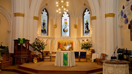
All Saints Church - Pontefract on the map, Pontefract, United Kingdom
Photo
Where is located All Saints Church - Pontefract
All Saints Church - Pontefract — local attraction, which is located at S Baileygate, Pontefract WF8 2JL, United Kingdom and belongs to the category — anglican church. Average visitor rating for this place — 4.4 (according to 58 ratings, information from open sources and relevant for 2022).
Exact location — All Saints Church - Pontefract, marked on the map with a red marker.
You can get directions to All Saints Church - Pontefract on the map from your location.
What else is interesting in Pontefract? You can see all the sights if you go to the city page.
Coordinates
All Saints Church - Pontefract, United Kingdom coordinates in decimal format: latitude — 53.69609909515951, longitude — -1.300832374598921. When converted to degrees, minutes, seconds All Saints Church - Pontefract has the following coordinates: 53°41′45.96 north latitude and -1°18′3 east longitude.
Nearby cities
The largest cities that are located nearby:
- Rotherham — 29 km
- Huddersfield — 32 km
- Sheffield — 36 km
- Manchester — 66 km
- Blackburn — 77 km
- Preston — 91 km
- Stoke-on-Trent — 96 km
- Liverpool — 115 km
- Leicester — 117 km
- Sutton Coldfield — 129 km
- Sunderland — 134 km
- Telford — 135 km
- West Bromwich — 138 km
- Birmingham — 139 km
- Dudley — 140 km
- Coventry — 143 km
- Northampton — 163 km
- Worcester — 177 km
- Cambridge — 191 km
Distance to the capital
Distance to the capital (London) is about — 256 km.