 Betteshanger
Lynton
Amesbury
Marlow
Burford
Chipping Norton
Marlborough
Cairnryan
Lydney
Betteshanger
Lynton
Amesbury
Marlow
Burford
Chipping Norton
Marlborough
Cairnryan
Lydney
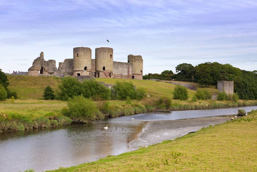
Rhuddlan Castle / Castell Rhuddlan on the map, Prestatyn, United Kingdom
Photo
Where is located Rhuddlan Castle / Castell Rhuddlan
Rhuddlan Castle / Castell Rhuddlan — local attraction, which is located at Castle St, Rhuddlan LL18 5AD, United Kingdom and belongs to the category — historical landmark. Average visitor rating for this place — 4.5 (according to 945 ratings, information from open sources and relevant for 2022).
Exact location — Rhuddlan Castle / Castell Rhuddlan, marked on the map with a red marker.
You can get directions to Rhuddlan Castle / Castell Rhuddlan on the map from your location.
What else is interesting in Prestatyn? You can see all the sights if you go to the city page.
Coordinates
Rhuddlan Castle / Castell Rhuddlan, United Kingdom coordinates in decimal format: latitude — 53.2891831194699, longitude — -3.4646653746142957. When converted to degrees, minutes, seconds Rhuddlan Castle / Castell Rhuddlan has the following coordinates: 53°17′21.06 north latitude and -3°27′52.8 east longitude.
Nearby cities
The largest cities that are located nearby:
- Liverpool — 29 km
- Preston — 66 km
- Blackburn — 75 km
- Manchester — 78 km
- Stoke-on-Trent — 90 km
- Telford — 97 km
- Huddersfield — 112 km
- Dudley — 128 km
- Sheffield — 128 km
- West Bromwich — 131 km
- Rotherham — 135 km
- Sutton Coldfield — 136 km
- Birmingham — 139 km
- Worcester — 150 km
- Coventry — 164 km
- Leicester — 171 km
- Cheltenham — 183 km
- Dublin
 (Ireland) — 188 km
 - Northampton — 208 km
Distance to the capital
Distance to the capital (London) is about — 301 km.