 Herbertstown
Dromagh
Roughgrove
Millstreet
County Dublin
Athy
Sallins
Ballybunnion
Fethard
Herbertstown
Dromagh
Roughgrove
Millstreet
County Dublin
Athy
Sallins
Ballybunnion
Fethard
Malahide Castle & Gardens on the map, Dundrum, Ireland
Photo
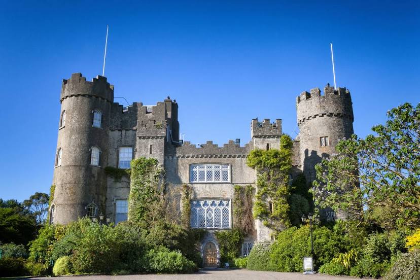
Where is located Malahide Castle & Gardens
Malahide Castle & Gardens — local attraction, which is located at Malahide Demesne, Malahide, Co. Dublin, K36 C432, Ireland and belongs to the category — castle. Average visitor rating for this place — 4.6 (according to 10401 rating, information from open sources and relevant for 2022).
Exact location — Malahide Castle & Gardens, marked on the map with a red marker.
You can get directions to Malahide Castle & Gardens on the map from your location.
What else is interesting in Dundrum? You can see all the sights if you go to the city page.
Coordinates
Malahide Castle & Gardens, Ireland coordinates in decimal format: latitude — 53.44432252440706, longitude — -6.164716674608424. When converted to degrees, minutes, seconds Malahide Castle & Gardens has the following coordinates: 53°26′39.56 north latitude and -6°9′52.98 east longitude.
Nearby cities
The largest cities that are located nearby:
- Belfast
 (United Kingdom) — 146 km
 - Liverpool (United Kingdom) — 215 km
- Cork — 217 km
- Preston (United Kingdom) — 237 km
- Blackburn (United Kingdom) — 251 km
- Telford (United Kingdom) — 263 km
- Manchester (United Kingdom) — 264 km
- Stoke-on-Trent (United Kingdom) — 272 km
- Dudley (United Kingdom) — 293 km
- Huddersfield (United Kingdom) — 295 km
- Worcester (Great Britain) — 298 km
- West Bromwich (United Kingdom) — 298 km
- Birmingham (United Kingdom) — 306 km
- Sutton Coldfield (United Kingdom) — 307 km
- Glasgow (United Kingdom) — 310 km
- Sheffield (United Kingdom) — 315 km
- Rotherham (United Kingdom) — 322 km
- Cheltenham (United Kingdom) — 323 km
- Bristol (Great Britain) — 323 km
Distance to the capital
Distance to the capital (Dublin) is about — 12 km.