 Herbertstown
Dromagh
Roughgrove
Millstreet
County Dublin
Athy
Sallins
Ballybunnion
Fethard
Herbertstown
Dromagh
Roughgrove
Millstreet
County Dublin
Athy
Sallins
Ballybunnion
Fethard
Marlay Park on the map, Dundrum, Ireland
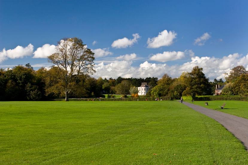
Photo
Where is located Marlay Park
Marlay Park — local attraction, which is located at Grange Rd, Rathfarnham, Dublin, D14 Y6X5, Ireland and belongs to the category — park. Average visitor rating for this place — 4.7 (according to 5963 ratings, information from open sources and relevant for 2022).
Exact location — Marlay Park, marked on the map with a red marker.
You can get directions to Marlay Park on the map from your location.
What else is interesting in Dundrum? You can see all the sights if you go to the city page.
Coordinates
Marlay Park, Ireland coordinates in decimal format: latitude — 53.27440490948491, longitude — -6.271516974614826. When converted to degrees, minutes, seconds Marlay Park has the following coordinates: 53°16′27.86 north latitude and -6°16′17.46 east longitude.
Nearby cities
The largest cities that are located nearby:
- Belfast
 (United Kingdom) — 146 km
 - Liverpool (United Kingdom) — 215 km
- Cork — 217 km
- Preston (United Kingdom) — 237 km
- Blackburn (United Kingdom) — 251 km
- Telford (United Kingdom) — 263 km
- Manchester (United Kingdom) — 264 km
- Stoke-on-Trent (United Kingdom) — 272 km
- Dudley (United Kingdom) — 293 km
- Huddersfield (United Kingdom) — 295 km
- Worcester (Great Britain) — 298 km
- West Bromwich (United Kingdom) — 298 km
- Birmingham (United Kingdom) — 306 km
- Sutton Coldfield (United Kingdom) — 307 km
- Glasgow (United Kingdom) — 310 km
- Sheffield (United Kingdom) — 315 km
- Rotherham (United Kingdom) — 322 km
- Cheltenham (United Kingdom) — 323 km
- Bristol (Great Britain) — 323 km
Distance to the capital
Distance to the capital (Dublin) is about — 8 km.