 Herbertstown
Dromagh
Roughgrove
Millstreet
County Dublin
Athy
Sallins
Ballybunnion
Fethard
Herbertstown
Dromagh
Roughgrove
Millstreet
County Dublin
Athy
Sallins
Ballybunnion
Fethard
Woodstock Golf & Country Club on the map, Ennis, Ireland
Photo
Where is located Woodstock Golf & Country Club
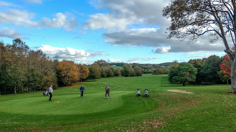
Woodstock Golf & Country Club — local attraction, which is located at Shanaway Rd, Ballylannidy, Ennis, Co. Clare, Ireland and belongs to the category — golf course. Average visitor rating for this place — 4.4 (according to 185 ratings, information from open sources and relevant for 2022).
Exact location — Woodstock Golf & Country Club, marked on the map with a red marker.
You can get directions to Woodstock Golf & Country Club on the map from your location.
What else is interesting in Ennis? You can see all the sights if you go to the city page.
Coordinates
Woodstock Golf & Country Club, Ireland coordinates in decimal format: latitude — 52.841561517888586, longitude — -9.029188274631096. When converted to degrees, minutes, seconds Woodstock Golf & Country Club has the following coordinates: 52°50′29.62 north latitude and -9°1′45.08 east longitude.
Nearby cities
The largest cities that are located nearby:
- Cork — 111 km
- Belfast
 (United Kingdom) — 275 km
 - Liverpool (United Kingdom) — 400 km
- Preston (United Kingdom) — 423 km
- Blackburn (United Kingdom) — 437 km
- Telford (United Kingdom) — 439 km
- Glasgow (United Kingdom) — 445 km
- Exeter (United Kingdom) — 449 km
- Manchester (United Kingdom) — 449 km
- Stoke-on-Trent (United Kingdom) — 453 km
- Worcester (Great Britain) — 464 km
- Dudley (United Kingdom) — 466 km
- Bristol (Great Britain) — 467 km
- West Bromwich (United Kingdom) — 472 km
- Birmingham (United Kingdom) — 480 km
- Huddersfield (United Kingdom) — 480 km
- Sutton Coldfield (United Kingdom) — 482 km
- Cheltenham (United Kingdom) — 483 km
- Edinburgh (United Kingdom) — 497 km
Distance to the capital
Distance to the capital (Dublin) is about — 193 km.