
 Pfarrwerfen
Rosenau am Hengstpaß
Grinzens
Sankt Martin am Wöllmißberg
Sankt Martin am Silberberg
Söding
Felixdorf
Oberpullendorf District
Fließ
Pfarrwerfen
Rosenau am Hengstpaß
Grinzens
Sankt Martin am Wöllmißberg
Sankt Martin am Silberberg
Söding
Felixdorf
Oberpullendorf District
Fließ
WiesenKönigReich on the map, Zell am See, Austria
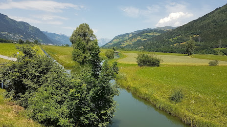
Photo
Where is located WiesenKönigReich
WiesenKönigReich — local attraction, which is located at Waagstraße 12, 5671 Bruck an der Großglocknerstraße, Austria and belongs to the category — observation deck. Average visitor rating for this place — 5.0 (according to 2 ratings, information from open sources and relevant for 2022).
Exact location — WiesenKönigReich, marked on the map with a red marker.
You can get directions to WiesenKönigReich on the map from your location.
What else is interesting in Zell am See? You can see all the sights if you go to the city page.
Coordinates
WiesenKönigReich, Austria coordinates in decimal format: latitude — 47.290594431963925, longitude — 12.809292125168996. When converted to degrees, minutes, seconds WiesenKönigReich has the following coordinates: 47°17′26.14 north latitude and 12°48′33.45 east longitude.
Nearby cities
The largest cities that are located nearby:
- Salzburg — 57 km
- Innsbruck — 105 km
- Munich
 (Germany) — 127 km
 - Linz — 154 km
- Augsburg (Germany) — 181 km
- Ingolstadt (Germany) — 188 km
- Trento
 (Italy) — 189 km
 - Ljubljana
 (Slovenia) — 192 km
 - Regensburg (Germany) — 194 km
- Trieste (Italy) — 200 km
- Graz — 201 km
- Venice (Italy) — 211 km
- Vicenza (Italy) — 220 km
- Ulm (Germany) — 238 km
- Verona (Italy) — 251 km
- Rijeka
 (Croatia) — 255 km
 - Nuremberg (Germany) — 266 km
- Pilsen
 (Czech Republic) — 270 km
 - Fürth (Germany) — 271 km
Distance to the capital
Distance to the capital (Vienna) is about — 285 km.