
 Pfarrwerfen
Rosenau am Hengstpaß
Grinzens
Sankt Martin am Wöllmißberg
Sankt Martin am Silberberg
Söding
Felixdorf
Oberpullendorf District
Fließ
Pfarrwerfen
Rosenau am Hengstpaß
Grinzens
Sankt Martin am Wöllmißberg
Sankt Martin am Silberberg
Söding
Felixdorf
Oberpullendorf District
Fließ
Museum Innviertler Volkskundehaus on the map, Ried im Innkreis, Austria
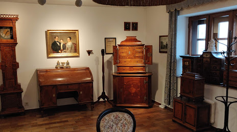
Photo
Where is located Museum Innviertler Volkskundehaus
Museum Innviertler Volkskundehaus — local attraction, which is located at Kirchenpl. 13, 4910 Ried im Innkreis, Austria and belongs to the category — museum. Average visitor rating for this place — 4.6 (according to 40 ratings, information from open sources and relevant for 2022).
Exact location — Museum Innviertler Volkskundehaus, marked on the map with a red marker.
You can get directions to Museum Innviertler Volkskundehaus on the map from your location.
What else is interesting in Ried im Innkreis? You can see all the sights if you go to the city page.
Coordinates
Museum Innviertler Volkskundehaus, Austria coordinates in decimal format: latitude — 48.209351805085696, longitude — 13.489847925200955. When converted to degrees, minutes, seconds Museum Innviertler Volkskundehaus has the following coordinates: 48°12′33.67 north latitude and 13°29′23.45 east longitude.
Nearby cities
The largest cities that are located nearby:
- Salzburg — 55 km
- Linz — 59 km
- Regensburg
 (Germany) — 134 km
 - Munich (Germany) — 141 km
- Ingolstadt (Germany) — 163 km
- Pilsen
 (Czech Republic) — 169 km
 - Innsbruck — 188 km
- Augsburg (Germany) — 191 km
- Graz — 193 km
- Prague (Czech Republic) — 217 km
- Nuremberg (Germany) — 221 km
- Fürth (Germany) — 228 km
- Erlangen (Germany) — 234 km
- Brno (Czech Republic) — 250 km
- Ljubljana
 (Slovenia) — 251 km
 - Ulm (Germany) — 258 km
- Bratislava
 (Slovakia) — 267 km
 - Trieste
 (Italy) — 284 km
 - Chemnitz (Germany) — 292 km
Distance to the capital
Distance to the capital (Vienna) is about — 214 km.