 Herbertstown
Dromagh
Roughgrove
Millstreet
County Dublin
Athy
Sallins
Ballybunnion
Fethard
Herbertstown
Dromagh
Roughgrove
Millstreet
County Dublin
Athy
Sallins
Ballybunnion
Fethard
Letterkenny Golf Club on the map, Letterkenny, Ireland
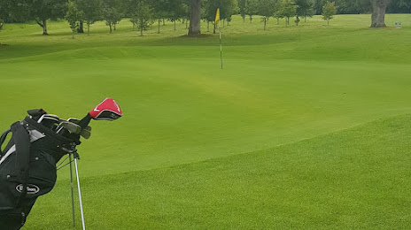
Photo
Where is located Letterkenny Golf Club
Letterkenny Golf Club — local attraction, which is located at Glebe, Barnhill, Co. Donegal, Ireland and belongs to the category — golf club. Average visitor rating for this place — 4.6 (according to 119 ratings, information from open sources and relevant for 2022).
Exact location — Letterkenny Golf Club, marked on the map with a red marker.
You can get directions to Letterkenny Golf Club on the map from your location.
What else is interesting in Letterkenny? You can see all the sights if you go to the city page.
Coordinates
Letterkenny Golf Club, Ireland coordinates in decimal format: latitude — 54.964049263416285, longitude — -7.684638374550514. When converted to degrees, minutes, seconds Letterkenny Golf Club has the following coordinates: 54°57′50.58 north latitude and -7°41′4.7 east longitude.
Nearby cities
The largest cities that are located nearby:
- Belfast
 (United Kingdom) — 122 km
 - Glasgow (United Kingdom) — 238 km
- Edinburgh (United Kingdom) — 302 km
- Cork — 342 km
- Preston (United Kingdom) — 354 km
- Liverpool (United Kingdom) — 356 km
- Blackburn (United Kingdom) — 368 km
- Manchester (United Kingdom) — 396 km
- Sunderland (United Kingdom) — 404 km
- Huddersfield (United Kingdom) — 416 km
- Stoke-on-Trent (United Kingdom) — 428 km
- Telford (United Kingdom) — 435 km
- Sheffield (United Kingdom) — 448 km
- Rotherham (United Kingdom) — 452 km
- Dudley (United Kingdom) — 467 km
- West Bromwich (United Kingdom) — 471 km
- Sutton Coldfield (United Kingdom) — 477 km
- Birmingham (United Kingdom) — 479 km
- Worcester (Great Britain) — 483 km
Distance to the capital
Distance to the capital (Dublin) is about — 202 km.