 Herbertstown
Dromagh
Roughgrove
Millstreet
County Dublin
Athy
Sallins
Ballybunnion
Fethard
Herbertstown
Dromagh
Roughgrove
Millstreet
County Dublin
Athy
Sallins
Ballybunnion
Fethard
Dún Ailinne on the map, Newbridge, Ireland
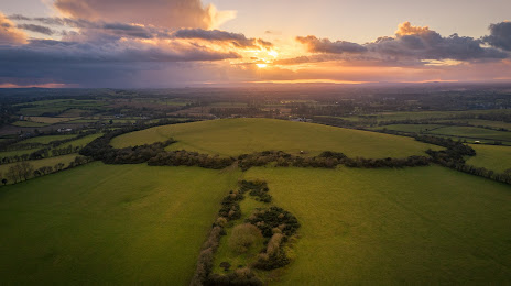
Photo
Where is located Dún Ailinne
Dún Ailinne — local attraction, which is located at Whitehall, Co. Kildare, Ireland and belongs to the category — historical landmark. Average visitor rating for this place — 5.0 (according to 1 rating, information from open sources and relevant for 2022).
Exact location — Dún Ailinne, marked on the map with a red marker.
You can get directions to Dún Ailinne on the map from your location.
What else is interesting in Newbridge? You can see all the sights if you go to the city page.
Coordinates
Dún Ailinne, Ireland coordinates in decimal format: latitude — 53.18515854922595, longitude — -6.808755774618185. When converted to degrees, minutes, seconds Dún Ailinne has the following coordinates: 53°11′6.57 north latitude and -6°48′31.52 east longitude.
Nearby cities
The largest cities that are located nearby:
- Belfast
 (United Kingdom) — 167 km
 - Cork — 182 km
- Liverpool (United Kingdom) — 253 km
- Preston (United Kingdom) — 276 km
- Blackburn (United Kingdom) — 289 km
- Telford (United Kingdom) — 297 km
- Manchester (United Kingdom) — 302 km
- Stoke-on-Trent (United Kingdom) — 308 km
- Dudley (United Kingdom) — 326 km
- Worcester (Great Britain) — 329 km
- West Bromwich (United Kingdom) — 332 km
- Huddersfield (United Kingdom) — 333 km
- Glasgow (United Kingdom) — 337 km
- Birmingham (United Kingdom) — 340 km
- Sutton Coldfield (United Kingdom) — 341 km
- Bristol (Great Britain) — 347 km
- Cheltenham (United Kingdom) — 352 km
- Sheffield (United Kingdom) — 353 km
- Exeter (United Kingdom) — 355 km
Distance to the capital
Distance to the capital (Dublin) is about — 41 km.