
 Gilserberg
Berlin
Bordesholm
Bechtolsheim
Aub
Triptis
Heppenheim
Biblis
Angermünde
Gilserberg
Berlin
Bordesholm
Bechtolsheim
Aub
Triptis
Heppenheim
Biblis
Angermünde
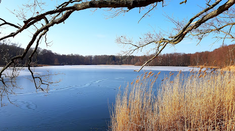
Niederer Waldteich on the map, Ottendorf-Okrilla, Germany
Photo
Where is located Niederer Waldteich
Niederer Waldteich — local attraction, which is located at no data and belongs to the category — -. Average visitor rating for this place — 4.3 (according to 9 ratings, information from open sources and relevant for 2022).
Exact location — Niederer Waldteich, marked on the map with a red marker.
You can get directions to Niederer Waldteich on the map from your location.
What else is interesting in Ottendorf-Okrilla? You can see all the sights if you go to the city page.
Coordinates
Niederer Waldteich, Germany coordinates in decimal format: latitude — 51.146322493310684, longitude — 13.722696197239825. When converted to degrees, minutes, seconds Niederer Waldteich has the following coordinates: 51°8′46.76 north latitude and 13°43′21.71 east longitude.
Nearby cities
The largest cities that are located nearby:
- Dresden — 16 km
- Cottbus — 72 km
- Chemnitz — 75 km
- Leipzig — 102 km
- Gera — 127 km
- Prague
 (Czech Republic) — 130 km
 - Zielona Gora
 (Poland) — 141 km
 - Potsdam — 143 km
- Berlin — 148 km
- Legnica (Poland) — 161 km
- Pilsen (Czech Republic) — 163 km
- Walbrzych (Poland) — 177 km
- Magdeburg — 182 km
- Gorzów Wielkopolski (Poland) — 195 km
- Erfurt — 196 km
- Wrocław (Poland) — 223 km
- Wolfsburg — 247 km
- Poznań (Poland) — 249 km
- Szczecin (Poland) — 253 km
Distance to the capital
Distance to the capital (Berlin) is about — 154 km.