
 Gilserberg
Berlin
Bordesholm
Bechtolsheim
Aub
Triptis
Heppenheim
Biblis
Angermünde
Gilserberg
Berlin
Bordesholm
Bechtolsheim
Aub
Triptis
Heppenheim
Biblis
Angermünde
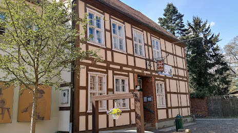
Urban and Regional Museum on the map, Perleberg, Germany
Photo
Where is located Urban and Regional Museum
Urban and Regional Museum — local attraction, which is located at Mönchort 7-11, 19348 Perleberg, Germany and belongs to the category — museum. Average visitor rating for this place — 4.8 (according to 27 ratings, information from open sources and relevant for 2022).
Exact location — Urban and Regional Museum, marked on the map with a red marker.
You can get directions to Urban and Regional Museum on the map from your location.
What else is interesting in Perleberg? You can see all the sights if you go to the city page.
Coordinates
Urban and Regional Museum, Germany coordinates in decimal format: latitude — 53.07621667576411, longitude — 11.860606825377749. When converted to degrees, minutes, seconds Urban and Regional Museum has the following coordinates: 53°4′34.38 north latitude and 11°51′38.18 east longitude.
Nearby cities
The largest cities that are located nearby:
- Wolfsburg — 102 km
- Magdeburg — 107 km
- Potsdam — 111 km
- Rostock — 114 km
- Berlin — 121 km
- Brunswick — 127 km
- Salzgitter — 145 km
- Hanover — 163 km
- Hildesheim — 164 km
- Kiel — 178 km
- Szczecin
 (Poland) — 182 km
 - Leipzig — 195 km
- Bremen — 203 km
- Göttingen — 216 km
- Bremerhaven — 221 km
- Cottbus — 224 km
- Gorzów Wielkopolski (Poland) — 229 km
- Erfurt — 238 km
- Gera — 243 km
Distance to the capital
Distance to the capital (Berlin) is about — 121 km.