 Herbertstown
Dromagh
Roughgrove
Millstreet
County Dublin
Athy
Sallins
Ballybunnion
Fethard
Herbertstown
Dromagh
Roughgrove
Millstreet
County Dublin
Athy
Sallins
Ballybunnion
Fethard
Arklow Maritime Museum on the map, Arklow, Ireland
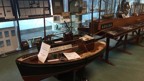
Photo
Where is located Arklow Maritime Museum
Arklow Maritime Museum — local attraction, which is located at N Quay, Ferrybank, Arklow, Co. Wicklow, Y14 Y744, Ireland and belongs to the category — museum. Average visitor rating for this place — 4.4 (according to 32 ratings, information from open sources and relevant for 2022).
Exact location — Arklow Maritime Museum, marked on the map with a red marker.
You can get directions to Arklow Maritime Museum on the map from your location.
What else is interesting in Arklow? You can see all the sights if you go to the city page.
Coordinates
Arklow Maritime Museum, Ireland coordinates in decimal format: latitude — 52.79847558895356, longitude — -6.149463474632704. When converted to degrees, minutes, seconds Arklow Maritime Museum has the following coordinates: 52°47′54.51 north latitude and -6°8′58.07 east longitude.
Nearby cities
The largest cities that are located nearby:
- Cork — 187 km
- Belfast
 (United Kingdom) — 200 km
 - Liverpool (United Kingdom) — 219 km
- Telford (United Kingdom) — 249 km
- Preston (United Kingdom) — 250 km
- Blackburn (United Kingdom) — 262 km
- Stoke-on-Trent (United Kingdom) — 266 km
- Manchester (United Kingdom) — 269 km
- Worcester (Great Britain) — 275 km
- Dudley (United Kingdom) — 276 km
- West Bromwich (United Kingdom) — 282 km
- Bristol (Great Britain) — 287 km
- Birmingham (United Kingdom) — 290 km
- Sutton Coldfield (United Kingdom) — 292 km
- Exeter (United Kingdom) — 294 km
- Cheltenham (United Kingdom) — 296 km
- Huddersfield (United Kingdom) — 302 km
- Coventry (United Kingdom) — 316 km
- Sheffield (United Kingdom) — 316 km
Distance to the capital
Distance to the capital (Dublin) is about — 62 km.