
 Staden
Geest-Gerompont-Petit-Rosière
Grote Hut
Sint-Job-in-'t-Goor
Deidenberg
De Pinte
Pussemange
Peruwelz
Barrière de Champlon
Staden
Geest-Gerompont-Petit-Rosière
Grote Hut
Sint-Job-in-'t-Goor
Deidenberg
De Pinte
Pussemange
Peruwelz
Barrière de Champlon
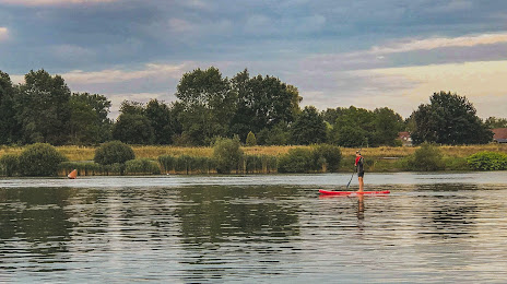
Canal Hensies-Pommeroeul on the map, Dour, Belgium
Photo
Where is located Canal Hensies-Pommeroeul
Canal Hensies-Pommeroeul — local attraction, which is located at no data and belongs to the category — -. Average visitor rating for this place — 4.2 (according to 49 ratings, information from open sources and relevant for 2022).
Exact location — Canal Hensies-Pommeroeul, marked on the map with a red marker.
You can get directions to Canal Hensies-Pommeroeul on the map from your location.
What else is interesting in Dour? You can see all the sights if you go to the city page.
Coordinates
Canal Hensies-Pommeroeul, Belgium coordinates in decimal format: latitude — 50.46154654333133, longitude — 3.6847611452046403. When converted to degrees, minutes, seconds Canal Hensies-Pommeroeul has the following coordinates: 50°27′41.57 north latitude and 3°41′5.14 east longitude.
Nearby cities
The largest cities that are located nearby:
- Charleroi — 47 km
- Lille
 (France) — 57 km
 - Namur — 77 km
- Antwerp — 100 km
- Amiens (France) — 120 km
- Reims (France) — 127 km
- Liège — 129 km
- Maastricht
 (Netherlands) — 142 km
 - Breda (Netherlands) — 148 km
- Tilburg (Netherlands) — 157 km
- Eindhoven (Netherlands) — 164 km
- Aachen
 (Germany) — 166 km
 - Dordrecht (Netherlands) — 168 km
- Rotterdam (Netherlands) — 175 km
- 's-Hertogenbosch (Netherlands) — 177 km
- The Hague (Netherlands) — 188 km
- Zoetermeer (Netherlands) — 190 km
- Paris (France) — 200 km
- Leiden (Netherlands) — 201 km
Distance to the capital
Distance to the capital (Brussels) is about — 64 km.