
 Staden
Geest-Gerompont-Petit-Rosière
Grote Hut
Sint-Job-in-'t-Goor
Deidenberg
De Pinte
Pussemange
Peruwelz
Barrière de Champlon
Staden
Geest-Gerompont-Petit-Rosière
Grote Hut
Sint-Job-in-'t-Goor
Deidenberg
De Pinte
Pussemange
Peruwelz
Barrière de Champlon
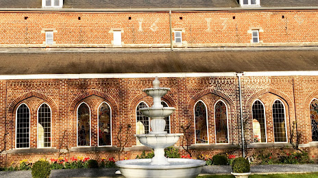
Abbaye de Bois-Seigneur-Isaac on the map, Braine-l'Alleud, Belgium
Photo
Where is located Abbaye de Bois-Seigneur-Isaac
Abbaye de Bois-Seigneur-Isaac — local attraction, which is located at Rue Armand de Moor 2, 1421 Ophain-Bois-Seigneur-Isaac, Belgium and belongs to the category — abbey. Average visitor rating for this place — 4.6 (according to 87 ratings, information from open sources and relevant for 2022).
Exact location — Abbaye de Bois-Seigneur-Isaac, marked on the map with a red marker.
You can get directions to Abbaye de Bois-Seigneur-Isaac on the map from your location.
What else is interesting in Braine-l'Alleud? You can see all the sights if you go to the city page.
Coordinates
Abbaye de Bois-Seigneur-Isaac, Belgium coordinates in decimal format: latitude — 50.64410636360333, longitude — 4.322786225287864. When converted to degrees, minutes, seconds Abbaye de Bois-Seigneur-Isaac has the following coordinates: 50°38′38.78 north latitude and 4°19′22.03 east longitude.
Nearby cities
The largest cities that are located nearby:
- Charleroi — 31 km
- Namur — 42 km
- Antwerp — 59 km
- Liège — 84 km
- Lille
 (France) — 93 km
 - Maastricht
 (Netherlands) — 93 km
 - Breda (Netherlands) — 103 km
- Tilburg (Netherlands) — 108 km
- Eindhoven (Netherlands) — 112 km
- Aachen
 (Germany) — 120 km
 - Dordrecht (Netherlands) — 127 km
- 's-Hertogenbosch (Netherlands) — 129 km
- Rotterdam (Netherlands) — 137 km
- Zoetermeer (Netherlands) — 152 km
- The Hague (Netherlands) — 153 km
- Mönchengladbach (Germany) — 153 km
- Nijmegen (Netherlands) — 160 km
- Reims (France) — 160 km
- Leiden (Netherlands) — 163 km
Distance to the capital
Distance to the capital (Brussels) is about — 23 km.