
 Warner Robins
Wantagh
Bethel
Misty Hill Farm
United States
Wakonda Beach (R33) Airport
Wilmington
Poland
Miami International Airport
Warner Robins
Wantagh
Bethel
Misty Hill Farm
United States
Wakonda Beach (R33) Airport
Wilmington
Poland
Miami International Airport
Farmington Bay Waterfowl Management Area on the map, Kaysville, United States
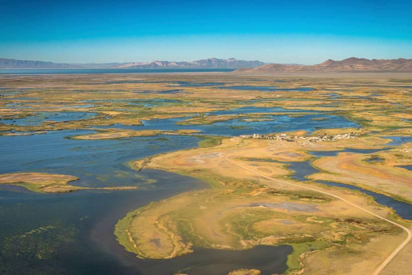
Photo
Where is located Farmington Bay Waterfowl Management Area
Farmington Bay Waterfowl Management Area — local attraction, which is located at 1325 W Glovers Ln, Farmington, UT 84025, United States and belongs to the category — wildlife refuge. Average visitor rating for this place — 4.6 (according to 374 ratings, information from open sources and relevant for 2022).
Exact location — Farmington Bay Waterfowl Management Area, marked on the map with a red marker.
You can get directions to Farmington Bay Waterfowl Management Area on the map from your location.
What else is interesting in Kaysville? You can see all the sights if you go to the city page.
Coordinates
Farmington Bay Waterfowl Management Area, United States coordinates in decimal format: latitude — 40.962359770430204, longitude — -111.92770137513251. When converted to degrees, minutes, seconds Farmington Bay Waterfowl Management Area has the following coordinates: 40°57′44.5 north latitude and -111°55′39.72 east longitude.
Nearby cities
The largest cities that are located nearby:
- Salt Lake City — 31 km
- West Valley City — 38 km
- West Jordan — 47 km
- Provo — 92 km
- Boise — 446 km
- Fort Collins — 578 km
- Arvada — 598 km
- Westminster — 601 km
- Lakewood — 602 km
- Thornton — 605 km
- North Las Vegas — 605 km
- Denver — 608 km
- Las Vegas — 609 km
- Henderson — 616 km
- Spring Valley — 620 km
- Aurora — 621 km
- Colorado Springs — 660 km
- Reno — 692 km
- Pueblo — 707 km
Distance to the capital
Distance to the capital (Washington) is about — 2965 km.