
 Staden
Geest-Gerompont-Petit-Rosière
Grote Hut
Sint-Job-in-'t-Goor
Deidenberg
De Pinte
Pussemange
Peruwelz
Barrière de Champlon
Staden
Geest-Gerompont-Petit-Rosière
Grote Hut
Sint-Job-in-'t-Goor
Deidenberg
De Pinte
Pussemange
Peruwelz
Barrière de Champlon
Verbeke Foundation on the map, Sint-Gillis-Waas, Belgium
Photo
Where is located Verbeke Foundation
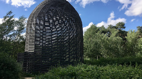
Verbeke Foundation — local attraction, which is located at Westakker, 9190 Kemzeke, Belgium and belongs to the category — modern art museum. Average visitor rating for this place — 4.3 (according to 1645 ratings, information from open sources and relevant for 2022).
Exact location — Verbeke Foundation, marked on the map with a red marker.
You can get directions to Verbeke Foundation on the map from your location.
What else is interesting in Sint-Gillis-Waas? You can see all the sights if you go to the city page.
Coordinates
Verbeke Foundation, Belgium coordinates in decimal format: latitude — 51.22751238603406, longitude — 4.054219625214543. When converted to degrees, minutes, seconds Verbeke Foundation has the following coordinates: 51°13′39.04 north latitude and 4°3′15.19 east longitude.
Nearby cities
The largest cities that are located nearby:
- Antwerp — 19 km
- Breda
 (Netherlands) — 60 km
 - Dordrecht (Netherlands) — 76 km
- Tilburg (Netherlands) — 76 km
- Rotterdam (Netherlands) — 82 km
- Charleroi — 92 km
- The Hague (Netherlands) — 95 km
- Eindhoven (Netherlands) — 96 km
- Zoetermeer (Netherlands) — 96 km
- 's-Hertogenbosch (Netherlands) — 97 km
- Namur — 98 km
- Lille
 (France) — 99 km
 - Leiden (Netherlands) — 107 km
- Maastricht (Netherlands) — 117 km
- Utrecht (Netherlands) — 118 km
- Liège — 121 km
- Hoofddorp (Netherlands) — 126 km
- Haarlem (Netherlands) — 134 km
- Nijmegen (Netherlands) — 134 km
Distance to the capital
Distance to the capital (Brussels) is about — 47 km.