 Betteshanger
Lynton
Amesbury
Marlow
Burford
Chipping Norton
Marlborough
Cairnryan
Lydney
Betteshanger
Lynton
Amesbury
Marlow
Burford
Chipping Norton
Marlborough
Cairnryan
Lydney
Trimley Sports & Social Club on the map, Felixstowe, United Kingdom
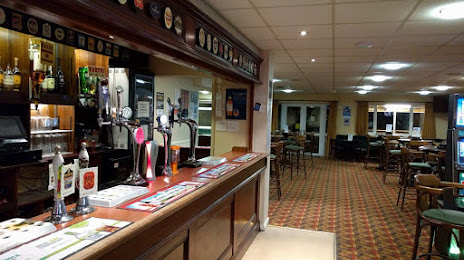
Photo
Where is located Trimley Sports & Social Club
Trimley Sports & Social Club — local attraction, which is located at High Rd, Trimley St Martin, Felixstowe IP11 0RJ, United Kingdom and belongs to the category — social club. Average visitor rating for this place — 4.3 (according to 151 rating, information from open sources and relevant for 2022).
Exact location — Trimley Sports & Social Club, marked on the map with a red marker.
You can get directions to Trimley Sports & Social Club on the map from your location.
What else is interesting in Felixstowe? You can see all the sights if you go to the city page.
Coordinates
Trimley Sports & Social Club, United Kingdom coordinates in decimal format: latitude — 51.99033094594181, longitude — 1.3082200252426541. When converted to degrees, minutes, seconds Trimley Sports & Social Club has the following coordinates: 51°59′25.19 north latitude and 1°18′29.59 east longitude.
Nearby cities
The largest cities that are located nearby:
- Ipswich — 17 km
- Southend-on-Sea — 64 km
- Chelmsford — 65 km
- Basildon — 73 km
- Norwich — 74 km
- Gillingham — 84 km
- Cambridge — 88 km
- Luton — 121 km
- Watford — 124 km
- Sutton — 126 km
- Crawley — 142 km
- Slough — 143 km
- Eastbourne — 151 km
- Northampton — 156 km
- Reading — 170 km
- Oxford — 180 km
- Leicester — 183 km
- Lille
 (France) — 190 km
 - Coventry — 200 km
Distance to the capital
Distance to the capital (London) is about — 113 km.