
 Staden
Geest-Gerompont-Petit-Rosière
Grote Hut
Sint-Job-in-'t-Goor
Deidenberg
De Pinte
Pussemange
Peruwelz
Barrière de Champlon
Staden
Geest-Gerompont-Petit-Rosière
Grote Hut
Sint-Job-in-'t-Goor
Deidenberg
De Pinte
Pussemange
Peruwelz
Barrière de Champlon
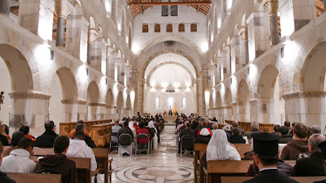
Abbaye Notre-Dame de Saint-Remy on the map, Rochefort, Belgium
Photo
Where is located Abbaye Notre-Dame de Saint-Remy
Abbaye Notre-Dame de Saint-Remy — local attraction, which is located at 5580 Rochefort, Belgium and belongs to the category — abbey. Average visitor rating for this place — 4.0 (according to 231 rating, information from open sources and relevant for 2022).
Exact location — Abbaye Notre-Dame de Saint-Remy, marked on the map with a red marker.
You can get directions to Abbaye Notre-Dame de Saint-Remy on the map from your location.
What else is interesting in Rochefort? You can see all the sights if you go to the city page.
Coordinates
Abbaye Notre-Dame de Saint-Remy, Belgium coordinates in decimal format: latitude — 50.1780147608745, longitude — 5.219560225270957. When converted to degrees, minutes, seconds Abbaye Notre-Dame de Saint-Remy has the following coordinates: 50°10′40.85 north latitude and 5°13′10.42 east longitude.
Nearby cities
The largest cities that are located nearby:
- Namur — 42 km
- Liège — 58 km
- Charleroi — 61 km
- Maastricht
 (Netherlands) — 83 km
 - Aachen
 (Germany) — 91 km
 - Trier (Germany) — 111 km
- Antwerp — 130 km
- Reims
 (France) — 132 km
 - Metz (France) — 134 km
- Mönchengladbach (Germany) — 141 km
- Eindhoven (Netherlands) — 143 km
- Bonn (Germany) — 146 km
- Cologne (Germany) — 149 km
- Neuss (Germany) — 154 km
- Tilburg (Netherlands) — 155 km
- Düsseldorf (Germany) — 160 km
- Breda (Netherlands) — 160 km
- Lille (France) — 160 km
- Krefeld (Germany) — 161 km
Distance to the capital
Distance to the capital (Brussels) is about — 97 km.