 Betteshanger
Lynton
Amesbury
Marlow
Burford
Chipping Norton
Marlborough
Cairnryan
Lydney
Betteshanger
Lynton
Amesbury
Marlow
Burford
Chipping Norton
Marlborough
Cairnryan
Lydney
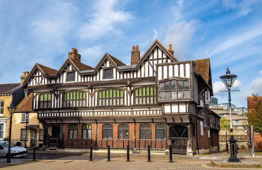
Tudor House & Garden on the map, Southampton, United Kingdom
Photo
Where is located Tudor House & Garden
Tudor House & Garden — local attraction, which is located at Bugle St, Southampton SO14 2AD, United Kingdom and belongs to the category — museum. Average visitor rating for this place — 4.4 (according to 810 ratings, information from open sources and relevant for 2022).
Exact location — Tudor House & Garden, marked on the map with a red marker.
You can get directions to Tudor House & Garden on the map from your location.
What else is interesting in Southampton? You can see all the sights if you go to the city page.
Coordinates
Tudor House & Garden, United Kingdom coordinates in decimal format: latitude — 50.899552530379836, longitude — -1.4059923747028467. When converted to degrees, minutes, seconds Tudor House & Garden has the following coordinates: 50°53′58.39 north latitude and -1°24′21.57 east longitude.
Nearby cities
The largest cities that are located nearby:
- Portsmouth — 24 km
- Bournemouth — 39 km
- Reading — 67 km
- Swindon — 76 km
- Slough — 87 km
- Crawley — 87 km
- Oxford — 94 km
- Sutton — 97 km
- Bristol — 101 km
- Watford — 108 km
- Cheltenham — 119 km
- Eastbourne — 120 km
- Luton — 126 km
- Gillingham — 145 km
- Basildon — 150 km
- Exeter — 151 km
- Northampton — 151 km
- Worcester — 152 km
- Chelmsford — 157 km
Distance to the capital
Distance to the capital (London) is about — 112 km.