 Betteshanger
Lynton
Amesbury
Marlow
Burford
Chipping Norton
Marlborough
Cairnryan
Lydney
Betteshanger
Lynton
Amesbury
Marlow
Burford
Chipping Norton
Marlborough
Cairnryan
Lydney
Purfleet Heritage & Military Centre on the map, Dartford, United Kingdom
Photo
Where is located Purfleet Heritage & Military Centre
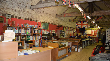
Purfleet Heritage & Military Centre — local attraction, which is located at Centurion Way, Purfleet RM19 1ZZ, United Kingdom and belongs to the category — museum. Average visitor rating for this place — 4.5 (according to 85 ratings, information from open sources and relevant for 2022).
Exact location — Purfleet Heritage & Military Centre, marked on the map with a red marker.
You can get directions to Purfleet Heritage & Military Centre on the map from your location.
What else is interesting in Dartford? You can see all the sights if you go to the city page.
Coordinates
Purfleet Heritage & Military Centre, United Kingdom coordinates in decimal format: latitude — 51.48433657388104, longitude — 0.22934112522397063. When converted to degrees, minutes, seconds Purfleet Heritage & Military Centre has the following coordinates: 51°29′3.61 north latitude and 0°13′45.63 east longitude.
Nearby cities
The largest cities that are located nearby:
- Basildon — 24 km
- Gillingham — 24 km
- Sutton — 30 km
- Southend-on-Sea — 36 km
- Chelmsford — 36 km
- Crawley — 47 km
- Watford — 48 km
- Slough — 56 km
- Luton — 65 km
- Eastbourne — 75 km
- Reading — 82 km
- Cambridge — 84 km
- Ipswich — 93 km
- Oxford — 106 km
- Portsmouth — 114 km
- Northampton — 116 km
- Southampton — 128 km
- Swindon — 138 km
- Norwich — 150 km
Distance to the capital
Distance to the capital (London) is about — 25 km.